
Pavement - General131 Richmond Hill Rd
The hedge etc belonging to 131 Richmond Hill Road has grown over a significant portion of the footpath on Sanscrit Place. It is a hazard as in places it is now…
323 council reports since June 2015, the 94th busiest suburb in the city. 244 photographs on record.
The record also holds 2023 Census snapshot· 244 photographs· 3 old photographs· 2 parks· the mapped tsunami reach covers 1% of the outline· slope-hazard bands cover 3% of the outline· the Ngāi Tahu schedule covers 100% of the outline· landscape schedules over 33% of the outline· setback strips over 5% of the outline· 141 SCIRT photographs filed on this ground· 3 drawn rules bind this ground· 3 parcels of made ground· 408 surveyed rocks· the 2019 model grades this ground mostly unlikely· 5 council structures on the register· 49 trees on the register· the plan’s word on this ground· 10 epicentres inside the outline· 1 injury crashes· 34 recorded victimisations· 1 business· the council’s fix times· 40 documents· 1 mention on the wire
Link-outs to the source’s own live pages, chch.live does not copy their live values or source text.
The ground: the mapped tsunami reach covers 1% of it, the rest of the watch is drawn further down.
Day to day it holds 2 parks, each is counted further down.
Lately the record’s mostly water & drains, 42 reports in the year to 12 October 2026, the newest 7 October 2026.
One for the quiz, Its busiest day on record was 24 February 2022, 3 reports in a single day.
About 78 people and 30 occupied private households in the “Port Hills” statistical area, grouped from 2 SA1 areas. A wider statistical area stands in for this suburb, so this is a proxy rather than a count for the suburb boundary.
Ethnicity is a multiple-response measure, so those percentages are not meant to add to 100%.
Stats NZ’s 2023 Census uses fixed random rounding to base 3. Unavailable or confidential cells are left out, not treated as zero. individuals · households · geography · CC BY 4.0.
Richmond Hill is a hillside suburb above Sumner in Christchurch, New Zealand.
Placed by the record’s locality join or the name in its own title, a lead, not a claim each frame stood here.
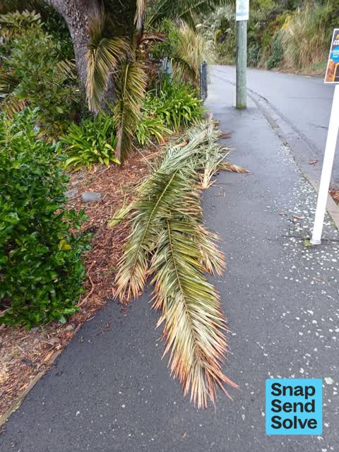
The hedge etc belonging to 131 Richmond Hill Road has grown over a significant portion of the footpath on Sanscrit Place. It is a hazard as in places it is now…


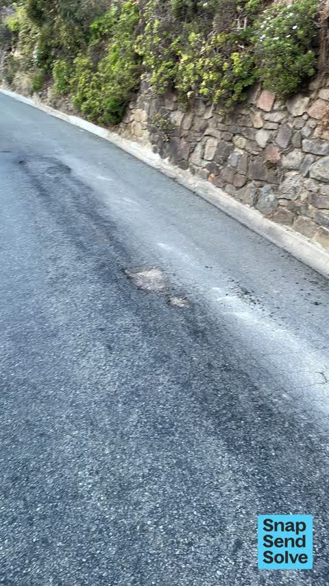
Hole in road, Richmond Hill Road. Outside address on photo! Very dangerous for cyclists!



This morning on my daily walked I slipped over on this footpath which is covered in lichen outside 2 properties 137 & 139 Richmond Hill Road,Richmond Hill…

Footpath overgrown with vegetation!!! This is the second time I’ve asked. Please do something this time!! Thanks


The median council work order pinned in Richmond Hill took 5 days to resolve, the city-wide median is 3 days, so this ground runs slower than the city as a whole. The slowest tenth waited 3 months or longer. 18 tickets are open here now, the oldest was filed 15 December 2021.
Work orders, not the resident reports above, the council’s MyCouncilTicket stream, and one job can appear in both. A median counts only finished jobs; open ones are named as open, never averaged in. The ticket roll · the whole city’s fix times.
Zoned for Christchurch Adventist School · Hillview Christian School · Marian College · Middleton Grange School · St Thomas of Canterbury College · Sumner School · and 2 more zones, the drawn zone is indicative; the Ministry’s written scheme is the legal boundary.
Parks and reserves in the council’s open data, a park lands in the suburb its centre falls inside. The whole roll is at /parks.
The mapped tsunami extent covers 1% of this outline. The sea’s modelled reach, not a prediction, the plan’s inundation line, not the evacuation zones; the share is read from a sampled join. The whole extent is drawn at /tsunami.
The plan’s slope-hazard bands cover 3% of this outline, mass movement management area 2, rockfall management area 2. The broad remaining-instability overlay covers 95% of it besides, the plan’s background watch over the hill country. Shares read from a sampled join; a management overlay, not a prediction. The whole watch is drawn at /slope.
The files record 3 parcels of made or characterised ground inside this outline. A record is the file’s word on what was laid, not a fresh survey; the whole layer is drawn at /fill.
The rockfall survey mapped 408 rocks inside this outline across 8 survey pins, 400 came down, 8 still wobble easy. A pin may stand for a cluster and marks where the survey saw the rock, not where it is now; the whole survey is drawn at /boulders.
The 2019 liquefaction study put 98% of this outline in the "unlikely" class. A class is the model’s verdict on a patch of ground, not a finding about an address; the whole study is drawn at /vulnerability.
The council’s structure register stands 5 assets on this ground, 4 sets of steps, 1 boardwalk, sited at Greenwood Park, Sanscrit Reserve, Ridgeway Linkage Reserve. The register’s site names are its own labels for the ground an asset stands in; the layer is drawn at the map.
The register counts 49 living trees inside this outline, 3 carrying a protection, mostly Fierce Toothed Lancewood, Akiraho, Pohutukawa. The file remembers 17 trees felled here. A tree record is the register’s word on what stands or stood; the whole canopy is drawn at /trees.
The plan files 51% of this outline under Residential Hills, 51% residential, the rest mostly Rural Port Hills 41%, Transport 9%. A zone is a permission, not a description, the mix is read from a sampled join of the plan’s polygons; the whole district is drawn at /zones.
The plan’s schedule of sites significant to Ngāi Tahu covers 100% of this outline, about 59 hectares, ngā tūranga tūpuna. Shares read from a sampled join; a recognition overlay, not a catalogue. The whole schedule is drawn at /cultural.
The plan’s landscape schedules cover 33% of this outline, about 19 hectares across 1 scheduled area, 33% of it outstanding, the plan’s strongest landscape standing, and 3% of it sits inside the coastal environment. Shares read from a sampled join; a protection overlay, not a ranking of views. The kept view is drawn at /landscape.
The plan’s water-margin layers cross this outline, 14 classified reaches, the plan calling Richmond Hill Waterway and Richmond Hill Road Drain by name, 5% of it inside the setback strips, the widest holding 10 m off the bank. The margin is the plan’s drawing, not a survey of the bank; the reaches, strips and held edges are mapped at /water-margin.
The rebuild’s cameras filed 141 photographs on this ground, 2011–2014, wastewater work mostly. Each frame is a receipt the dig left behind, a work log, not a survey of what stands now; the whole record is drawn at /rebuild.
The rulebook binds this ground, 3 drawn instruments, 2 of them dog rules, 1 bottle-store buffer; the outline sits inside the takiwā of Te Ngai Tuahuriri Runanga. The bylaw is the instrument, this the map of it, the whole rulebook is drawn at /rules.
GeoNet’s catalogue puts 10 magnitude-3+ epicentres inside this outline since the sequence opened, the biggest a M5.3 in 2011. An epicentre is where the instruments placed the break, not a measure of the shaking here; the whole catalogue is counted at /sequence, the live record is /quakes, and the story in plain language is the earthquakes explainer.
1 crash that hurt somebody on record inside Richmond Hill's outline, 0 seriously hurt, nobody killed.
The corner that keeps appearing: Richmond Hill Road at Nayland Street, 1 injury crash.
34 victimisations on the Police record inside Richmond Hill’s outline, September 2022–August 2026, mostly theft, about 109 a year per 1,000 residents. Down 22% on the year before. Reported is not all, how much never reaches the record depends on the offence.
1 premises in Richmond Hill across 1 kind, from OpenStreetMap, the council’s licensed-premises register and its 2024 Find Christchurch directory. Each kind below opens at this suburb’s shelf.
What the archive’s sources say about Richmond Hill, titled for it, turned up by a search for one of its places, or carrying its name in the text. These are leads and citations: the originals live at the provider, linked from each row.
houses land q ijvr sle several allotments in the township 1 of richmond hill apply to richardson it reynolds land nml estate ajrents prinres-stwft corner of hurli-tnet a lan…Otago Daily Times · Papers Past · National Library of New Zealand · · text held
…y cut up and conveyed to one of the butcher shops in town a meeting of the inhabitants of richmond hill mornington and primrose hill was held on friday evening last in the drill shed for the purpose o…Otago Witness · Papers Past · National Library of New Zealand · · text held
kichmond silver mining company the richmond hill silver mining company are raising very rich ore in quantity estimated to be worth 130 per ton ch…Auckland Star · Papers Past · National Library of New Zealand · · text held
The rest are a search away, the whole shelf, for the name →
Compare Richmond Hill with Sumner · Clifton · Moncks Bay · Scarborough · Redcliffs · te-onepoto-taylors-mistake, same record, side by side.
Richmond Hill is a hillside suburb above Sumner in Christchurch, New Zealand. The public record holds 323 council reports for it, the first filed in June 2015.
About 78 people and 30 occupied private households (wider SA2 stand-in): grouped from Stats NZ SA1 areas through this site’s suburb join. Indicative, not a LIM.
323 reports on record, most often water & drains (117), roads & footpaths (98), trees & parks (65). 42 of them in the year to 12 October 2026.
1 injury crash on the police record inside the suburb’s outline, 0 seriously hurt, nobody killed. The suburb’s crashes, mapped →
GeoNet’s catalogue puts 10 magnitude-3+ epicentres inside the suburb’s mapped outline since the September 2010 mainshock, the biggest a M5.3 in 2011. An epicentre is where the instruments placed the break, not a measure of the shaking felt here. The whole sequence, counted → · The story, in plain language →
Every suburb in Christchurch → · Its decade, charted → · the whole A–Z →
Work orders, not the resident reports above, the council’s MyCouncilTicket stream, and one job can appear in both. A median counts only finished jobs; open ones are named as open, never averaged in. The ticket roll · the whole city’s fix times.
The council’s bylaw zones and the Local Alcohol Policy’s buffer list, read from the Regulatory open-data service. A ban rules drinking in public places; it says nothing about whether a premises may sell, that is the licence register’s job.
Ministry of Education directory, the final decile and the current Equity Index describe the community a school draws from, not how well it teaches. Zones are indicative; the written enrolment scheme rules.
Parks and reserves in the council’s open data, the park lands in the suburb its centre falls inside; one that straddles the line keeps its own address.
Libraries, halls, cemeteries and the rest in the council’s open data, a facility lands in the suburb its point or centre falls inside.
Places of worship in the open map’s record, one lands in the suburb its building stands in. The whole roll is at /worship.
Marae in the region’s roll, a marae stands where it stands; the join names the suburb the roll files it under. The whole roll is at /maraes.
Walking, biking, horse and off-road tracks in the council’s open data, a line belongs to every suburb it passes through.
OpenStreetMap’s own record, inside this outline, a pin is the mapper’s; a waterway belongs to every suburb it crosses. Every roll, counted: /geography.
Heritage places the council’s district plan or Heritage New Zealand list inside this suburb, each with what is known about it and the document it is known from.
The register’s era records for places in this suburb, what stood on the ground, and when.
Each of these is a decade of reports, the heritage places on the register, what is known about them, and the documents behind it, everything the archive holds about the part of the city it names.