The numbered streets
Twenty-four register entries in four streets, Winchester’s run of nine listed dwellings is one of the densest residential rows on the register, and Canterbury, Oxford and St Davids keep their own rows around the corner. The port’s everyday houses, street by street.
The walk, as a line
Straight between pins, the streets run longer. Every numbered pin opens that place’s own record.
The stops, in order
- Dwelling and Setting, 39 Winchester Street · 20 unread leads
39 Winchester, the west end of the row.
- Dwelling and Setting, 38 Winchester Street · 20 unread leads
38 Winchester.
- Dwelling and Setting, 36 Winchester Street · 20 unread leads
36 Winchester.
- Dwelling and Setting, 34 Winchester Street · 20 unread leads
34 Winchester.
- Dwelling and Setting, 32 Winchester Street · 20 unread leads
32 Winchester.
- Dwelling and Setting, 28 Winchester Street · 20 unread leads
28 Winchester.
- Dwelling and Setting, 23 Winchester Street · 20 unread leads
23 Winchester, across the road, the row continues.
- Dwelling and Setting, 13 Winchester Street · 20 unread leads
13 Winchester.
- Dwelling and Setting, 3 Winchester Street · 20 unread leads
3 Winchester, the row’s east end.
- Dwelling and Setting, 45A Canterbury Street · 21 unread leads
45A Canterbury, one of two entries at the same address.
- Dwelling and Setting, 45A Canterbury Street · 21 unread leads
45A Canterbury, the other.
- Dwelling and Setting, 49 Canterbury Street · 21 unread leads
49 Canterbury, next door.
- Dwelling and Setting, 47 Oxford Street · 20 unread leads
47 Oxford, the first of Oxford’s row.
- Dwelling and Setting, 51 Oxford Street · 20 unread leads
51 Oxford.
- Dwelling and Setting, 53 Oxford Street · 20 unread leads
53 Oxford.
- Dwelling and Setting, 59 Oxford Street · 20 unread leads
59 Oxford, the row’s east end.
- Commercial Building and Setting, 20 Oxford Street · 24 unread leads
20 Oxford, a commercial building among the dwellings.
- Commercial Building and Setting, 13 Oxford Street · 21 unread leads
13 Oxford, the second shopfront.
- Dwelling and Setting, 75 St Davids Street · 20 unread leads
75 St Davids, up the hill for the last street.
- Dwelling and Setting, 22 St Davids Street · 20 unread leads
22 St Davids.
- Dwelling and Setting, 28 St Davids Street · 20 unread leads
28 St Davids.
- Dwelling and Setting, 32 St Davids Street · 20 unread leads
32 St Davids.
- Dwelling and Setting, 30 St Davids Street · 21 unread leads
30 St Davids.
- Dwelling and Setting, 34 St Davids Street · 20 unread leads
34 St Davids, the last door on the last row.
What the register built on the way
Council structures within about 30 m of the stop-to-stop line, the bridges, steps and shelters the route passes. Site names are the register’s own.
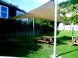 A shelter at Norman Kirk Memorial Pool 1 m off the line
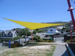 A shelter at Oxford Street Reserve, built 2008 2 m off the line
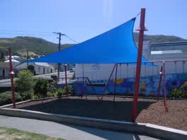 A shelter at Oxford Street Reserve, built 2008 2 m off the line
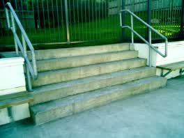 A set of steps at Norman Kirk Memorial Pool, 5 steps 2 m off the line
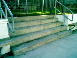 A set of steps at Norman Kirk Memorial Pool, 5 steps 3 m off the line
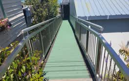 A ramp at Lyttelton Recreation Centre, 15.64 m long · built 1899 6 m off the line
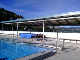 A shelter at Norman Kirk Memorial Pool 7 m off the line
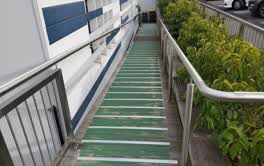 A ramp at Lyttelton Recreation Centre, 19.35 m long · built 1899 23 m off the line
The reports along it
2,254 council reports pinned within 150 m of the line, most often Graffiti & vandalism and Water & drains, 1,924 with a photograph. A pin is where a reporter stood, not a claim about the place itself.
 Facility - General Request
 Graffiti on a fence, building or structure
 Public Toilet
 Overgrown Vegetation
 Street Gutters / Storm Water
 Overgrown Vegetation
 Road Signage
 Graffiti on a fence, building or structure
 Facility - General Request
 Graffiti on a fence, building or structure
Questions, answered briefly
Twenty-four register entries in four streets, Winchester’s run of nine listed dwellings is one of the densest residential rows on the register, and Canterbury, Oxford and St Davids keep their own rows around the corner. 24 listed places, 2.2 km as the line runs, Lyttelton.
Dwelling and Setting (39 Winchester Street) to Dwelling and Setting (34 St Davids Street), the order is a suggestion, not the only way round.
Every one, each pin is a row in the district plan’s heritage schedule, and each opens the place’s own sourced record here.
2.2 km measured straight between the pins, the streets run longer, and the stops deserve a pause each.
The record behind this
Every stop is a row in the district plan’s heritage schedule, held here as the register’s own layer. The order and the notes are ours, the listings are the council’s and Heritage New Zealand’s. "Setting" is the register’s word for the ground a listing covers.
The rest of the register here: Lyttelton
The same ground today: Lyttelton
More walks over this ground: The port’s first streets · The port’s own town
This page as markdown: /walks/lyttelton-streets.md · the route as data: /walks/lyttelton-streets.geojson · on the live map: the walks layer.