14 Riccarton Avenue, Christchurch Central City
140 reports on record since April 2016 · 104 with photographs. The most-reported address on Riccarton Avenue. Indicative rating valuation and school zones, hazards, bin day and what stood here before.
What gets reported here
Photographed here 104 on record







Reported here the newest 80 of 140
 Pothole,
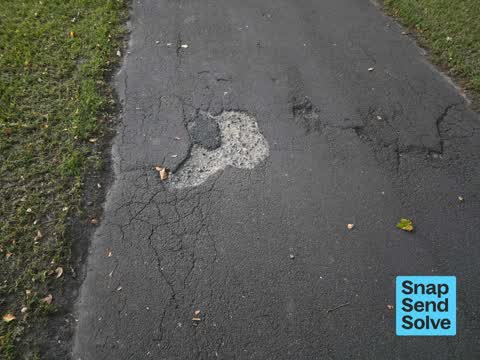
On Riccarton Ave, driving towards deans ave, there is a massive pot hole at least 300mm wide and probably at l ast 100 deep - could probably
 Public Toilet,
disabled toilet broken door handle
 Road Blockage,
Randomly closed path. Takes people to a dead end.
 Dumped Rubbish,
 Graffiti on a sign, mural or public art,
Graffiti now obscuring part of the sign
 Roads - General,
abandoned road come
 Pavement - Damaged,
hole 8n path
 Graffiti on a traffic light pole or cabinet, or wa,
 Graffiti on a sign, mural or public art,
 Sewer General,
Missing metql great lid.
 Street Gutters / Storm Water,
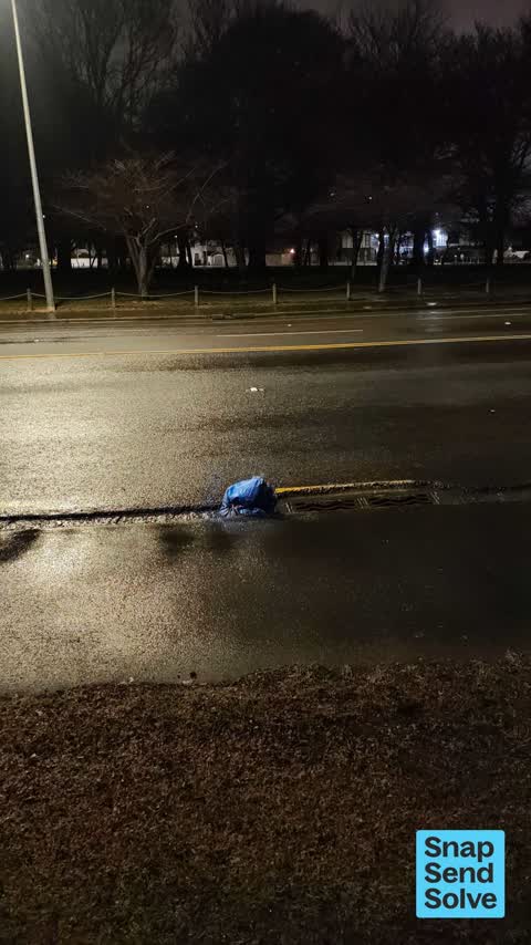
unsecured drain cover with no lock on it. was a quater open but i've closed it just needs lock.
 Rubbish and Bins - General,
bin full and jammed shut
 Litter,
 Litter,
 Dumped Rubbish,
sign in pond
 Dumped Rubbish,
 Pavement - Damaged,
Noth Hagley perimeter path with lots of potholes on Ric Ave between river and Deans Ave
 Trees - General,
snapped branch hanging above side path - potential risk to pedestrians especially in wind. branch approx circumference of a human wrist at n
 Facility - General Request,
Great to see the map here thanks but what is the orange line meaning? Is that also closed or is that things remaining open?
 Graffiti on a playground or in a park,
- Park - General Request,
Broken picnic table
 Fallen Tree,
Fallen branch in Hagley park golf course near the toilets.
 Hazard, vehicle,
This car has been parked in the EV carpark at the botanic gardens for over 1.5hours it is not an EV car so is not charging.
 Hazard, vehicle,
Car parked in EV carpark, not an EV car so not charging.
 Public Toilet,
Toilet valve not shutting off and wasting water
 Graffiti on a sign, mural or public art,
 Pavement - General,
Hazard. It is almost impossible to see the change in pavement in the dark due to faded green paint and shadows. The grass area is also sunk
 Facility - General Request,
The outlet from LIttle Victoria Lake seems to be blocked, causing minor flooding as shown.
 Park - General Request,
Someone has been strong enough to remove the bridge that usually crosses the drain
 Hazard, vehicle,
Poor ux design, and I want to pay cash but can't. How can I pay you if I don't have a bank card? Is there a better way?
 Park - General Request,
Blocked Footpath Footpath alongside Botanical Gardens access road is still blocked by temporary fences from the Electric Avenue festival (s
 Accessibility,
Blocked Footpath Footpath alongside Botanical Gardens access road is still blocked by temporary fences from the Electric Avenue festival (s
 General Request,
This is now the first signage when approaching from un cycleway. Worse than it was Friday. Needs to be 100m further west.
 General Request,
This signage needs to be positioned about 100m further west to avoid the late discovery and then need for uturns to access the southern deto
 Pest / Vermin,
The Canadian geese are getting worse in Hagley Park. Their poo is disgusting and they appear to wandering further afield. They are only g
 Water Leak,
Im not sure what it is but its been leaking for hours and has created a new pond for the ducks aha. But still should be fixed ASAP
 Pest / Vermin,
Canadian Geese excrement is a public nuisance, a health issue and an eye sore around Lake Victoria and Hagley Park in general. These birds n
 Rubbish and Bins - General,
Bin won't open , jammed ,
 Pit and Equipment - General,
Drain cover missing. This is dangerous.
 Pavement - Damaged,
this needs to be covered it’s on the footpath
 Pit and Equipment - General,
No cover on this footpath storm water drain (think it’s one of those). Someone has already placed a broken branch over it Location is on R
 Pit and Equipment - General,
Grate missing
 Pit and Equipment - General,
Stormwater grate missing from path
 Pavement - Damaged,
Still a big drain open on the side walk which seems like a hazard, another one further down the road has some cones in it at least to highli
 Accessibility,
This footpath is missing. As a cyclist at night I had a near miss hitting the grass and large dirt hole. The signage inviting cyclists to me
 Pavement - General,
These drains seem very unsafe I nearly fell down into one. Are they due to be covered?
 Park - General Request,
Broken glass on footpath cycleway
 Graffiti on a cabinet, pole or railway asset,
 Park - General Request,
There are goldfish or koi in Victoria Lake that need to be removed.
 Roads - General,
Re Temporary Traffic Management Footpath resealing works on Riccarton Ave have a 30kph TSL in place. Unfortunately, an uncovered permanent
 Roads - General,
Re Temporary Traffic Management Shared path on Riccarton Ave near Deans Ave has been mostly blocked by two roadworks signs, despite presenc
 Facility - General Request,
Broken board on footbridge
- Animal - General,
Koi Carp or ex goldfish, have they always been in Victoria Lake, in Hagley Park?
 Vandalism - General,
The iron coyote/dog sculptures at Lake Victoria in Hagley Park have been thrown into the lake by some idiots. They are are a great addition
 Park - General Request,
The table and seat has nails sticking out of it which is very dangerous
- Fallen Tree,
Tree has fallen over in Hagley park about opposite brockworrh place
 Graffiti somewhere else,
On lamppost walkway Hagley Park nearing tennis courts from Riccarton Rd
 Graffiti on a sign, mural or public art,
Graffiti on back of a sign
 Public Toilet,
Please ensure cleaning done regularly, very smelly. I was here on Monday too and smelly until now.
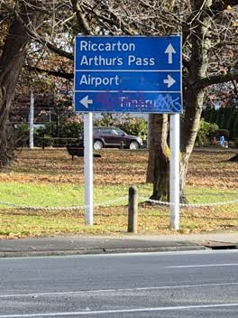 Graffiti somewhere else,
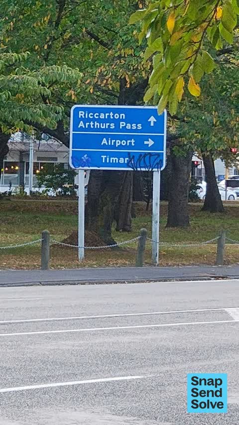
Blue direction sign on Riccarton Ave with graffiti obscuring lower writing - Timaru?
- Pest / Vermin,
Possum sightings. Possum sounds. Urgently need pest control at Hagley Park. Even sighting during the day. Might have even been a stoat.
 Hazard, vehicle,
Parking across a footpath. It makes the road in and out of the gardens carpark so narrow and dangerous.
 Flooding,
This was recently constructed, but blocks an overflow spillway between the two ponds.
 Trees - General,
Tree 112155 plane tree has hanging broken branch
 Hazard, vehicle,
Parking on footpath
 Overgrown Vegetation,
To Parks. The raupo that looks to have been either illegally planted or introduced by Council into Lake Albert in North Hagley Park looks t
 Litter,
Walking through north Hagley park today between Riccarton road and the botanical gardens (along the footpath). I noticed a lot of dumped can
 Rubbish and Bins - General,
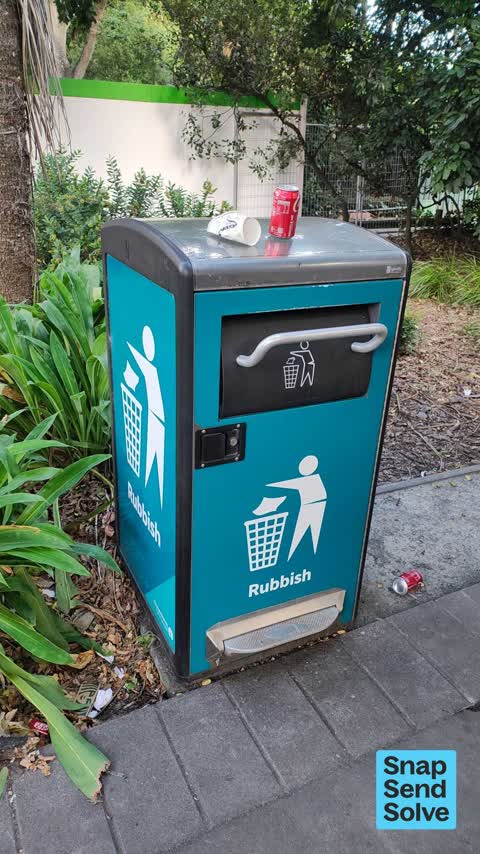
Full bin so people putting stuff on top.
 Rubbish and Bins - General,
 Hazard, vehicle,
Many cars parked across the car park illegally at the botanic gardens car park
 Public Toilet,
Door on handicap toilet doesn’t close or lock
 Pit and Equipment - General,
Cover is loose and potential fall hazard
 Public Toilet,
The second one from the left facing north doesn’t lock at all. The handle just spins.
- Rubbish and Bins - General,
- Poles and Signage - General,
- Park - General Request,
- Damaged Road,
- Damaged Road,
- Graffiti,
- Park - General Request,
60 more on record, the live page pages them.
Also reported on Riccarton Avenue
- 2 Riccarton Avenue, 84 reports
- 8 Riccarton Avenue, 83 reports
- 16 Riccarton Avenue, 77 reports
- 12 Riccarton Avenue, 61 reports
- 71 Riccarton Avenue, 52 reports
- 10 Riccarton Avenue, 40 reports
- 6 Riccarton Avenue, 37 reports
- 63 Riccarton Avenue, 26 reports
From the air, then
Sourced from Canterbury Maps and partners. LINZ, CC BY 3.0 NZ. Each frame is cut from Environment Canterbury’s historic imagery MapServer for that decade, only where the Footprints layer names a CC BY survey (NZAM-covered spots stay out). RetroLens holds more Crown aerials →
The street’s crash record
NZTA’s record names Riccarton Avenue in 63 crashes that hurt somebody since 2006, 17 seriously hurt, nobody killed.
The green nearby
- Botanic Gardens, you are in it · Botanic · 21 ha
- Hagley Park North, 97 m to the edge · Sports ground · 91 ha
- Hagley Park South, 387 m to the edge · Sports ground · 71 ha
Parks within half a kilometre, measured to the boundary, the council’s open data.
On the doorstep
- Lucky Duck, 74 m away · Cafés
- the Good Company, 81 m away · Venues & events
- ilex Cafe, 92 m away · Cafés
- Botanic Gardens Tour, 171 m away · Attractions
Businesses within four hundred metres, measured at the pin: OpenStreetMap and the council directories.
The bus nearby
- Riccarton Ave, 371 m away · route 3, route 5, route 80, route 86
- Riccarton Ave, 391 m away · route 3, route 5, route 80, route 86
The closest Metro stops, within four hundred and fifty metres.
The tracks through here
- Walk and bike track through Christchurch Central City, 161 m to the line · walk · bike
- Walk and bike track through Christchurch Central City, 270 m to the line · walk · bike
- Walk and bike track through Christchurch Central City, 311 m to the line · walk · bike
- Walk and bike track through Christchurch Central City, 329 m to the line · walk · bike
- Walk and bike track through Christchurch Central City, 392 m to the line · walk · bike
Tracks whose line passes within half a kilometre, measured to the line itself, the council’s open data.
The named ground
Named water within 500 m of this address, measured to the line or the edge; Named places within 1.5 km of this address; the council’s own structure register, bridges, boardwalks and steps standing nearby, the open map’s record.
The remembered names nearby
- In Memory of / Judith Mary Heenan / 1934-2007, 19 m away ·
In memory of / Judith Mary Heenan / 1934-2007 / "A life of love"
· 2008 - In Memory of / Ernie Heenan, 19 m away ·
In memory of / Ernie Heenan / 19.6.1930 - 21.2.2009 / "A life of devotion"
· 2009 - In Memory of / Chris Heenan, 19 m away ·
In memory of / Chris Heenan / 07.01.1964 - 19.03.2025 / "A life full of love and devotion"
Inscribed plaques within two hundred and fifty metres, the register’s pins, not surveyed spots. The whole roll is at /plaques.
Renting nearby
new bonds in Christchurch Central City ran about $508 a week, $42 below the city median of $550, the suburb page keeps the rent record →.
What was here, Hagley Park
on this spot · located to ±1230 m · the place’s own record →
On the register. Nothing researched here yet.
What was here, Cuningham House and Setting
199 m away · 7 Riccarton Avenue · located to ±20 m · the place’s own record →
On the register. Nothing researched here yet.
The civic layer
This ground votes in Central ward, the Papanui-Innes-Central community board. Ward lines don’t always follow suburb lines; this one is measured at the pin, not the suburb’s centre.
What stood on this ground → · On the map → · From the air, the Crown’s aerials back to 1936; search the address on RetroLens →
Questions, answered briefly
140 council reports on record since April 2016, most often graffiti (25), parks (14), park - general request (12).
Christchurch Central City, Christchurch, on Riccarton Avenue.
The heritage register names 2 places at or beside it, Hagley Park, Cuningham House and Setting.
Botanic Gardens, the address is inside it, 21 ha.