145 Lichfield Street, Christchurch Central City
12 reports on record since October 2020 · 9 with photographs. The street’s heaviest record is 160 Lichfield Street — 37 reports on file. Indicative rating valuation and school zones, hazards, bin day and what stood here before.
What gets reported here
Photographed here 9 on record


Reported here
 Park - General Request —
 Support for new tree ripped out by vandals
 Dumped Rubbish —
 flytipping. two large weights left on the footpath overnight. both seem damaged.
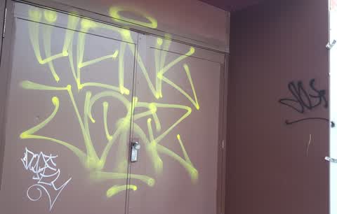
 Graffiti on a fence, building or structure —
 On the fence surrounding the new stadium. This graffiti has been on this fence for over two weeks. The taggers have moved across the road an
 Graffiti somewhere else —
 Te kaha
 Roads - General —
 Lichfield St is closed off at Madras Street for the next two weeks but traffic on Madras still gets a red light. The signal should be left p
 Graffiti on a fence, building or structure —
 Blue black and silver paint tags on signs on stadium fence at the corner of Lichfield and Madras Streets.
 Graffiti on a fence, building or structure —
 white graffiti on black fence signage
 Graffiti —
 Right along madras st tekaha temp stadium fencing has graffiti
- Roads - General —
Traffic Lights: green light facing south is out on the northeast corner of the intersection.
- Graffiti —
- Hazard — vehicle —
 Graffiti —
 Allen Street and Madras Street at the corner, Christchurch city which is in front of Ara institute of Canterbury city campus.
Also reported on Lichfield Street
- 160 Lichfield Street — 37 reports
- 84 Lichfield Street — 27 reports
- 90 Lichfield Street — 25 reports
- 71 Lichfield Street — 25 reports
- 116 Lichfield Street — 22 reports
- 60 Lichfield Street — 19 reports
- 140 Lichfield Street — 19 reports
- 81 Lichfield Street — 18 reports
The street’s crash record
NZTA’s record names Lichfield Street in 71 crashes that hurt somebody since 2006 — 14 seriously hurt, nobody killed.
The green nearby
- Excelsior Hotel Reserve — 230 m to the edge · Botanic
- Latimer Square — 238 m to the edge · Botanic · 2 ha
- Wilson Park — 269 m to the edge
- City Mall — 389 m to the edge
- High Street Triangles — 416 m to the edge
Parks within half a kilometre, measured to the boundary — the council’s open data.
The civic shelf nearby
Libraries, halls and the rest within half a kilometre — the council’s open data.
On the doorstep
- Domino's — 40 m away · Fast food
- Ginger Cafe & Eatery — 52 m away · Restaurants
- Fre Fratelli Fried Pizza — 60 m away · Restaurants
- NG Boutique — 66 m away · Business
Businesses within four hundred metres, measured at the pin — OpenStreetMap and the council directories.
The bus nearby
- Tuam St near Madras St — 142 m away · route 1, route 3, route 5, route 80
- Hereford St near Latimer Square — 244 m away · route 60
The closest Metro stops, within four hundred and fifty metres.
The tracks through here
- Walk and bike track through Christchurch Central City — 138 m to the line · walk · bike
- Walk and bike track through Christchurch Central City — 191 m to the line · walk · bike
- Walk and bike track through Christchurch Central City — 255 m to the line · walk · bike
- Walk and bike track through Christchurch Central City — 259 m to the line · walk · bike
- Walk and bike track through Christchurch Central City — 353 m to the line · walk · bike
Tracks whose line passes within half a kilometre, measured to the line itself — the council’s open data.
The named ground
Named places within 1.5 km of this address; the council’s own structure register — bridges, boardwalks and steps standing nearby — the open map’s record.
The remembered names nearby
- ‘corgis on High’ — Christchurch City Public Artwork — 203 m away ·
‘Corgis on High’ — Christchurch City public artwork, 6 December 2003
· 2009 - The First Public Water Supply Well Was Drilled Near This — 205 m away ·
THE FIRST PUBLIC WATER SUPPLY WELL was drilled near this site on 10 February 1864 by the C
· 2009
Inscribed plaques within two hundred and fifty metres — the register’s pins, not surveyed spots. The whole roll is at /plaques.
Renting nearby
new bonds in Christchurch Central City ran about $508 a week — $42 below the city median of $550 — the suburb page keeps the rent record →.
What was here — Façade and Setting, Former New Zealand Farmers’ Co-operative Association of Canterbury Ltd
142 m away · 214 Cashel Street · located to ±26 m · the place’s own record →
On the register. Nothing researched here yet.
What was here — Commercial Building and Setting, Former C F Cotter and Company
177 m away · 101/158 High Street · located to ±19 m · the place’s own record →
On the register. Nothing researched here yet.
What was here — 158 High Street
188 m away · G01/158 High Street · located to ±6 m · the place’s own record →
On the register. Nothing researched here yet.
What was here — Triangle Reserve and Setting
205 m away · 189F High Street · located to ±17 m · the place’s own record →
On the register. Nothing researched here yet.
What was here — Commercial Building Façade and Setting, Former A J Whites
208 m away · 181 High Street · located to ±20 m · the place’s own record →
On the register. Nothing researched here yet.
The civic layer
This ground votes in Central ward — the Papanui-Innes-Central community board. Ward lines don’t always follow suburb lines; this one is measured at the pin, not the suburb’s centre.
What stood on this ground → · On the map → · From the air — the Crown’s aerials back to 1936; search the address on RetroLens →
Questions, answered briefly
12 council reports on record since October 2020 — most often graffiti on a fence, building or structure (3), graffiti (3), roads - general (2).
Christchurch Central City, Christchurch — on Lichfield Street.
The heritage register names 5 places at or beside it — Façade and Setting, Former New Zealand Farmers’ Co-operative Association of Canterbury Ltd, Commercial Building and Setting, Former C F Cotter and Company.
Excelsior Hotel Reserve — 230 m to its edge.