25-27 Lichfield Street, Christchurch Central City
18 reports on record since December 2017 · 16 with photographs. The street’s heaviest record is 160 Lichfield Street — 37 reports on file. Indicative rating valuation and school zones, hazards, bin day and what stood here before.
What gets reported here
- Graffiti — 4
- Pavement - General — 2
- Damaged Street Sign — 2
- Trees - General — 1
- Sign Poles — 1
- Roading/Streets — 1
Photographed here 16 on record


Reported here
 Damaged Street Sign —
sticker covering the sign unable to enforce time restriction
 Sign Poles —
p5 signage is partially covered by stickers signage says ; P5 6pm to 4am.
 Poles and Signage - General —
multiple graffiti stickers on p 5 sign and post
 Graffiti on a fence, building or structure —
graffiti stickers on light lamp post pole
 Damaged Street Sign —
Sign P5 6pm to 4am has a stickers on it.
 Litter —
Kia ora, some fool had left a whole lot of foam bits scattered all over the road :( Thanks for your mahi, Anne
 Pavement - Damaged —
Seat is broken
 Pavement - General —
Bench seat adjacent to justice precinct damaged again. Suspect repair to reinstate was not good enough
 Pit and Equipment - General —
 Pavement - General —
Beach seat pulled out of ground. Needs removing/fixing
 Graffiti somewhere else —
Tables near entrance to 33 Litchfield park
- Trees - General —
- General Request —
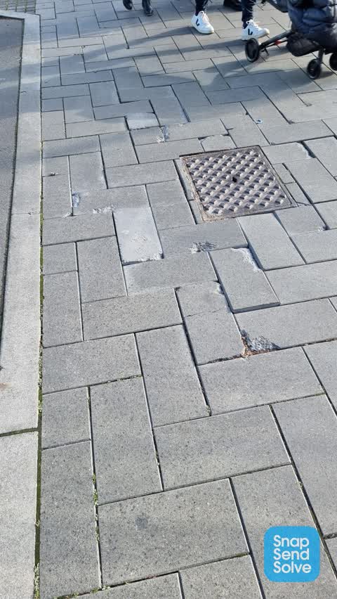
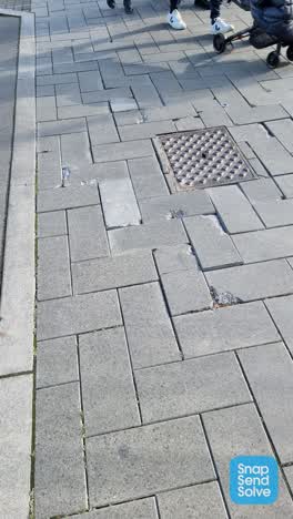 Roading/Streets —
The bricks are broken and raised, leading to trips and a dangerous surface
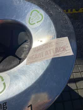 Graffiti —
Anti vax sticky tag on steel recycling bin by police station needs removal.
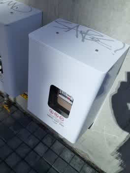 Graffiti —
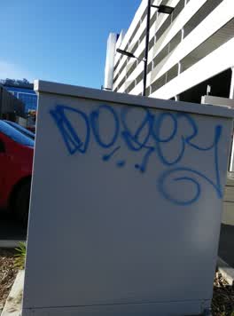 Graffiti —
Opposite the police station
Graffiti —
Also reported on Lichfield Street
- 160 Lichfield Street — 37 reports
- 84 Lichfield Street — 27 reports
- 90 Lichfield Street — 25 reports
- 71 Lichfield Street — 25 reports
- 116 Lichfield Street — 22 reports
- 60 Lichfield Street — 19 reports
- 140 Lichfield Street — 19 reports
- 81 Lichfield Street — 18 reports
The street’s crash record
NZTA’s record names Lichfield Street in 71 crashes that hurt somebody since 2006 — 14 seriously hurt, nobody killed.
The green nearby
- Friendship Corner — 114 m to the edge · Botanic
- Bridge Of Remembrance — 152 m to the edge · Botanic
- Tiffany Reserve — 153 m to the edge
- City Mall — 187 m to the edge
- The Stewart Plaza — 245 m to the edge
Parks within half a kilometre, measured to the boundary — the council’s open data.
The civic shelf nearby
- Re:start - Lichfield St — 127 m away · Car park
- Triangle — 240 m away · Car park
- Scales — 330 m away · Car park
- Civic Offices — 370 m away · Council office
- Turanga Library — 489 m away · Library · Cathedral Square, Christchurch
Libraries, halls and the rest within half a kilometre — the council’s open data.
On the doorstep
- The General Store — 43 m away · Business
- Little Fish Co. — 60 m away · Seafood
- Alchemy Equipment Outlet Store — 64 m away · Clothing
- Dosa Kitchen — 66 m away · Fast food
Businesses within four hundred metres, measured at the pin — OpenStreetMap and the council directories.
The bus nearby
- Bus Interchange (Intercity stop) — 178 m away · route 3, route 8, route 80
- Bus Interchange (Platform A) — 195 m away · route 3, route 5, route 60, route 80, route 81, route 84, route 85, route 86
The closest Metro stops, within four hundred and fifty metres.
The tracks through here
- Walk and bike track through Christchurch Central City — 104 m to the line · walk · bike
- Walk and bike track through Christchurch Central City — 114 m to the line · walk · bike
- Walk and bike track through Christchurch Central City — 121 m to the line · walk · bike
- Walk and bike track through Christchurch Central City — 125 m to the line · walk · bike
- Walk and bike track through Christchurch Central City — 311 m to the line · walk · bike
Tracks whose line passes within half a kilometre, measured to the line itself — the council’s open data.
The named ground
Named water within 500 m of this address, measured to the line or the edge; Named places within 1.5 km of this address; the council’s own structure register — bridges, boardwalks and steps standing nearby — the open map’s record.
The remembered names nearby
- The Chapel Is Open 1 Pm to 4 Pm Daily Closed Sundays — 137 m away ·
THE CHAPEL IS OPEN 1 PM TO 4 PM DAILY CLOSED SUNDAYS & CHRISTMAS DAY
· 2009 - Friendship Corner / Sister Cities — 145 m away ·
FRIENDSHIP CORNER / Sister Cities / (list largely illegible on inlay)
· 2010 - Planted on 14th April 1983 by His Excellency Premier Zhao — 151 m away ·
PLANTED ON 14TH APRIL 1983 BY HIS EXCELLENCY PREMIER ZHAO ZIYANG OF THE PEOPLE'S REPUBLIC
· 2009
Inscribed plaques within two hundred and fifty metres — the register’s pins, not surveyed spots. The whole roll is at /plaques.
Renting nearby
new bonds in Christchurch Central City ran about $508 a week — $42 below the city median of $550 — the suburb page keeps the rent record →.
What was here — St Michael's School Stone Building and Setting
148 m away · located to ±16 m · the place’s own record →
On the register. Nothing researched here yet.
What was here — St. Michael and All Angels Church & Setting
153 m away · 90 Oxford Terrace · located to ±25 m · the place’s own record →
On the register. Nothing researched here yet.
What was here — St Michael's School Hall and Setting
154 m away · 243 Durham Street South · located to ±14 m · the place’s own record →
On the register. Nothing researched here yet.
What was here — Former Dwelling and Setting
156 m away · 95 Oxford Terrace · located to ±18 m · the place’s own record →
On the register. Nothing researched here yet.
What was here — St Michael and All Angels Church Belfry and Setting
172 m away · 90 Oxford Terrace · located to ±5 m · the place’s own record →
On the register. Nothing researched here yet.
The civic layer
This ground votes in Central ward — the Papanui-Innes-Central community board. Ward lines don’t always follow suburb lines; this one is measured at the pin, not the suburb’s centre.
What stood on this ground → · On the map → · From the air — the Crown’s aerials back to 1936; search the address on RetroLens →
Questions, answered briefly
18 council reports on record since December 2017 — most often graffiti (4), pavement - general (2), damaged street sign (2).
Christchurch Central City, Christchurch — on Lichfield Street.
The heritage register names 5 places at or beside it — St Michael's School Stone Building and Setting, St. Michael and All Angels Church & Setting.
Friendship Corner — 114 m to its edge.