32 Lichfield Street, Christchurch Central City
15 reports on record since August 2016 · 11 with photographs. The street’s heaviest record is 160 Lichfield Street — 37 reports on file. Indicative rating valuation and school zones, hazards, bin day and what stood here before.
What gets reported here
- Graffiti — 4
- Roading/Streets — 2
- Road Signage — 1
- Pothole — 1
- Pavement - Damaged — 1
- Park - General Request — 1
Photographed here 11 on record





Reported here
 Park - General Request —
 Vandalised trees on border of Lichfield St carpark for Riverside. This is a pic of one of them. Two have been snapped. These are salvageabl
 Hazard — vehicle —
 Private vehicle in a loading zone
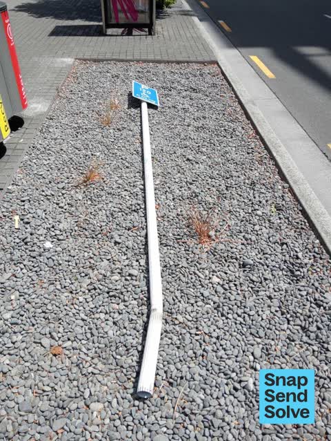
 Damaged Street Sign —
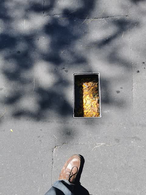
  Pothole —
 Uncovered manhole on footpath at entrance to the central carpark on Litchfield street. An elderly lady tripped in the hole and fell over.
 Fallen Tree —
 Not really a fallen tree but branch down.
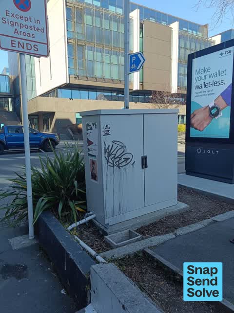
 Graffiti on a cabinet, pole or railway asset —
  Graffiti somewhere else —
 - Graffiti —
- Road Signage —
- Graffiti —
- Pavement - Damaged —
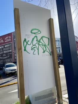 Graffiti —
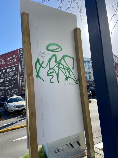
 Green and black paint tags on reverse side of parking sign facing the footpath on Lichfield Street opposite police station.
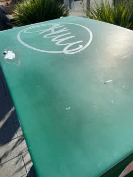 Graffiti —
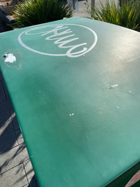
 Silver paint tag on green CN826 asset opposite police station on Lichfield Street.
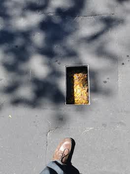 Roading/Streets —
 Cover neeeded
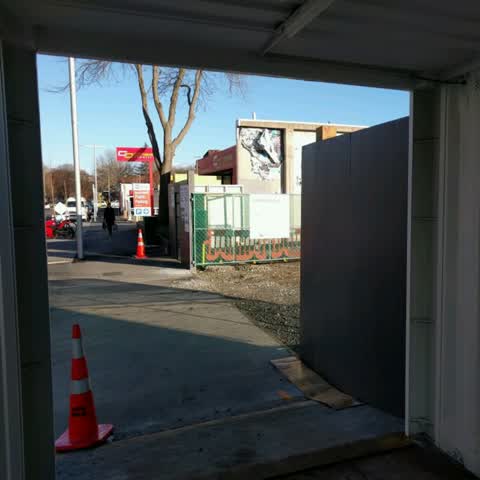
Roading/Streets —
Photo shows exit of pedestrian container path adjacent to entrance and exit from construction site for new ccc car park. Construction vehicl
Also reported on Lichfield Street
- 160 Lichfield Street — 37 reports
- 84 Lichfield Street — 27 reports
- 90 Lichfield Street — 25 reports
- 71 Lichfield Street — 25 reports
- 116 Lichfield Street — 22 reports
- 60 Lichfield Street — 19 reports
- 140 Lichfield Street — 19 reports
- 81 Lichfield Street — 18 reports
The street’s crash record
NZTA’s record names Lichfield Street in 71 crashes that hurt somebody since 2006 — 14 seriously hurt, nobody killed.
The green nearby
- Friendship Corner — 97 m to the edge · Botanic
- Tiffany Reserve — 135 m to the edge
- Bridge Of Remembrance — 144 m to the edge · Botanic
- City Mall — 210 m to the edge
- The Stewart Plaza — 266 m to the edge
Parks within half a kilometre, measured to the boundary — the council’s open data.
The civic shelf nearby
- Re:start - Lichfield St — 140 m away · Car park
- Triangle — 262 m away · Car park
- Scales — 311 m away · Car park
- Civic Offices — 363 m away · Council office
Libraries, halls and the rest within half a kilometre — the council’s open data.
On the doorstep
- Little Fish Co. — 43 m away · Seafood
- The Mediterranean Food Co — 50 m away · Cafés
- Dosa Kitchen — 51 m away · Fast food
- Curiosity Gin — 53 m away · Bottle stores
Businesses within four hundred metres, measured at the pin — OpenStreetMap and the council directories.
The bus nearby
- Bus Interchange (Intercity stop) — 200 m away · route 3, route 8, route 80
- Bus Interchange (Platform A) — 213 m away · route 3, route 5, route 60, route 80, route 81, route 84, route 85, route 86
The closest Metro stops, within four hundred and fifty metres.
The tracks through here
- Walk and bike track through Christchurch Central City — 85 m to the line · walk · bike
- Walk and bike track through Christchurch Central City — 101 m to the line · walk · bike
- Walk and bike track through Christchurch Central City — 102 m to the line · walk · bike
- Walk and bike track through Christchurch Central City — 116 m to the line · walk · bike
- Walk and bike track through Christchurch Central City — 315 m to the line · walk · bike
Tracks whose line passes within half a kilometre, measured to the line itself — the council’s open data.
The named ground
Named water within 500 m of this address, measured to the line or the edge; Named places within 1.5 km of this address; the council’s own structure register — bridges, boardwalks and steps standing nearby — the open map’s record.
The remembered names nearby
- The Chapel Is Open 1 Pm to 4 Pm Daily Closed Sundays — 125 m away ·
THE CHAPEL IS OPEN 1 PM TO 4 PM DAILY CLOSED SUNDAYS & CHRISTMAS DAY
· 2009 - Friendship Corner / Sister Cities — 135 m away ·
FRIENDSHIP CORNER / Sister Cities / (list largely illegible on inlay)
· 2010 - Planted on 14th April 1983 by His Excellency Premier Zhao — 138 m away ·
PLANTED ON 14TH APRIL 1983 BY HIS EXCELLENCY PREMIER ZHAO ZIYANG OF THE PEOPLE'S REPUBLIC
· 2009
Inscribed plaques within two hundred and fifty metres — the register’s pins, not surveyed spots. The whole roll is at /plaques.
Renting nearby
new bonds in Christchurch Central City ran about $508 a week — $42 below the city median of $550 — the suburb page keeps the rent record →.
What was here — St Michael's School Stone Building and Setting
125 m away · located to ±16 m · the place’s own record →
On the register. Nothing researched here yet.
What was here — St. Michael and All Angels Church & Setting
130 m away · 90 Oxford Terrace · located to ±25 m · the place’s own record →
On the register. Nothing researched here yet.
What was here — St Michael's School Hall and Setting
132 m away · 243 Durham Street South · located to ±14 m · the place’s own record →
On the register. Nothing researched here yet.
What was here — Former Dwelling and Setting
136 m away · 95 Oxford Terrace · located to ±18 m · the place’s own record →
On the register. Nothing researched here yet.
What was here — St Michael and All Angels Church Belfry and Setting
149 m away · 90 Oxford Terrace · located to ±5 m · the place’s own record →
On the register. Nothing researched here yet.
The civic layer
This ground votes in Central ward — the Papanui-Innes-Central community board. Ward lines don’t always follow suburb lines; this one is measured at the pin, not the suburb’s centre.
What stood on this ground → · On the map → · From the air — the Crown’s aerials back to 1936; search the address on RetroLens →
Questions, answered briefly
15 council reports on record since August 2016 — most often graffiti (4), roading/streets (2), road signage (1).
Christchurch Central City, Christchurch — on Lichfield Street.
The heritage register names 5 places at or beside it — St Michael's School Stone Building and Setting, St. Michael and All Angels Church & Setting.
Friendship Corner — 97 m to its edge.