33 Lichfield Street, Christchurch Central City
17 reports on record since December 2018 · 12 with photographs. The street’s heaviest record is 160 Lichfield Street — 37 reports on file. Indicative rating valuation and school zones, hazards, bin day and what stood here before.
What gets reported here
- Graffiti — 6
- Hazard — vehicle — 4
- Roading/Streets — 3
- Public Toilet — 1
- Parks — 1
- General Request — 1
Photographed here 12 on record



Reported here
 Hazard — vehicle —
 Hello, i entered the council carpark on lichfield street today(23.05.25)at 7:30am REG PMG504, Black Lexus, i parked on the 4th floor in the
 General Request —
 An EV charger on level 2 of the parking building is not working.
 Hazard — vehicle —
 This EV charger on level 2c of the Lichfield Street Carpark hasn't been working for quite some time. Possibly months.
 Graffiti —
 Posters put on all the poles on Plymouth Lane
- Hazard — vehicle —
On the first level of parking, the EV charging unit that supplies the third and fourth parks (counted from the lift) is not working.
- Graffiti —
- Graffiti —
- Graffiti —
- Hazard — vehicle —
 Public Toilet —
 Can we stop the storage of the homeless stuff? Most of the lockers have locks on them and only a few bikes. Tourists are coming and this loo
 Graffiti —
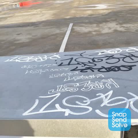
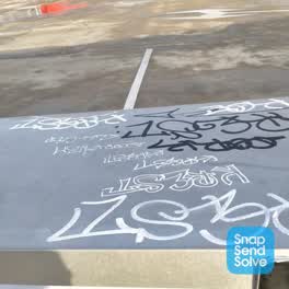
 Graffiti on the roof of Lichfield carpark on top of ledge between level 7 and level 8
 Graffiti —
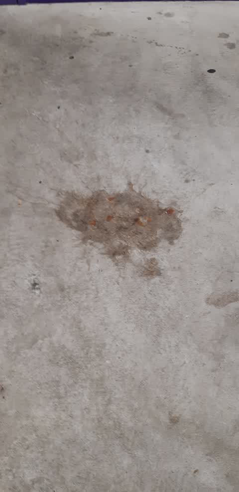
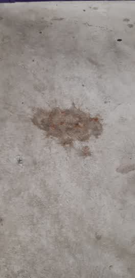
 Not graffiti but vomit that has been on the landing on level 2a of the Lichfield car park building for over a week
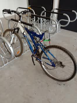 Parks —
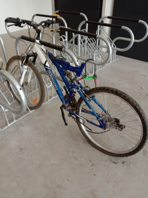
 This bike has been in the carpark bike shed for a year, about time it was removed. When are the windows going to be cleaned in the carpark b
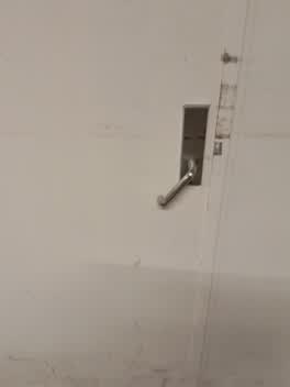 Facility - General Request —
 lock in rubbish room, windows need washing haven't been done since the carpark opended and the arena at stairs needs washing.
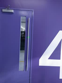 Roading/Streets —
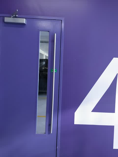
 level 4 door in the purple stairwell nearest cashel at needs more gas as it is slamming
Roading/Streets —
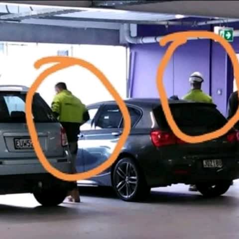
Contractors? parking in disabled car park space at Lichfield St carpark. This photo was taken by a friend whose elderly disabled mother didn
Roading/Streets —
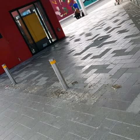
Bird crap outside 33 Lichfield St parking building. It stnks, is a health hazard and a slip hazard.
Also reported on Lichfield Street
- 160 Lichfield Street — 37 reports
- 84 Lichfield Street — 27 reports
- 90 Lichfield Street — 25 reports
- 71 Lichfield Street — 25 reports
- 116 Lichfield Street — 22 reports
- 60 Lichfield Street — 19 reports
- 140 Lichfield Street — 19 reports
- 81 Lichfield Street — 18 reports
The street’s crash record
NZTA’s record names Lichfield Street in 71 crashes that hurt somebody since 2006 — 14 seriously hurt, nobody killed.
The green nearby
- Friendship Corner — 130 m to the edge · Botanic
- Bridge Of Remembrance — 151 m to the edge · Botanic
- City Mall — 156 m to the edge
- Tiffany Reserve — 167 m to the edge
- The Stewart Plaza — 212 m to the edge
Parks within half a kilometre, measured to the boundary — the council’s open data.
The civic shelf nearby
- Re:start - Lichfield St — 131 m away · Car park
- Triangle — 208 m away · Car park
- Scales — 343 m away · Car park
- Civic Offices — 366 m away · Council office
- Turanga Library — 457 m away · Library · Cathedral Square, Christchurch
Libraries, halls and the rest within half a kilometre — the council’s open data.
On the doorstep
- The General Store — 29 m away · Business
- Black and White Coffee Cartel — 42 m away · Cafés
- J-Bings — 43 m away · Fast food
- Fika — 48 m away · Cafés
Businesses within four hundred metres, measured at the pin — OpenStreetMap and the council directories.
The bus nearby
- Bus Interchange (Intercity stop) — 162 m away · route 3, route 8, route 80
- Bus Interchange (Platform B) — 185 m away · route 1, route 7, route 8, route 27, route 44, route 91, route 92, route 95
The closest Metro stops, within four hundred and fifty metres.
The tracks through here
- Walk and bike track through Christchurch Central City — 120 m to the line · walk · bike
- Walk and bike track through Christchurch Central City — 122 m to the line · walk · bike
- Walk and bike track through Christchurch Central City — 140 m to the line · walk · bike
- Walk and bike track through Christchurch Central City — 152 m to the line · walk · bike
- Walk and bike track through Christchurch Central City — 291 m to the line · walk · bike
Tracks whose line passes within half a kilometre, measured to the line itself — the council’s open data.
The named ground
Named water within 500 m of this address, measured to the line or the edge; Named places within 1.5 km of this address; the council’s own structure register — bridges, boardwalks and steps standing nearby — the open map’s record.
The remembered names nearby
- The Chapel Is Open 1 Pm to 4 Pm Daily Closed Sundays — 142 m away ·
THE CHAPEL IS OPEN 1 PM TO 4 PM DAILY CLOSED SUNDAYS & CHRISTMAS DAY
· 2009 - Friendship Corner / Sister Cities — 147 m away ·
FRIENDSHIP CORNER / Sister Cities / (list largely illegible on inlay)
· 2010 - Friendship Corner plaque — 154 m away ·
(illegible – triangular emblem plaque)
· 2010
Inscribed plaques within two hundred and fifty metres — the register’s pins, not surveyed spots. The whole roll is at /plaques.
Renting nearby
new bonds in Christchurch Central City ran about $508 a week — $42 below the city median of $550 — the suburb page keeps the rent record →.
What was here — Former Beaths Department Store (components)
156 m away · 201/690 Colombo Street · located to ±21 m · the place’s own record →
On the register. Nothing researched here yet.
What was here — Former Dwelling and Setting
174 m away · 95 Oxford Terrace · located to ±18 m · the place’s own record →
On the register. Nothing researched here yet.
What was here — Bridge of Remembrance and Setting
175 m away · 88 Cambridge Terrace · located to ±27 m · the place’s own record →
On the register. Nothing researched here yet.
What was here — St Michael's School Stone Building and Setting
178 m away · located to ±16 m · the place’s own record →
On the register. Nothing researched here yet.
What was here — St. Michael and All Angels Church & Setting
180 m away · 90 Oxford Terrace · located to ±25 m · the place’s own record →
On the register. Nothing researched here yet.
The civic layer
This ground votes in Central ward — the Papanui-Innes-Central community board. Ward lines don’t always follow suburb lines; this one is measured at the pin, not the suburb’s centre.
What stood on this ground → · On the map → · From the air — the Crown’s aerials back to 1936; search the address on RetroLens →
Questions, answered briefly
17 council reports on record since December 2018 — most often graffiti (6), hazard — vehicle (4), roading/streets (3).
Christchurch Central City, Christchurch — on Lichfield Street.
The heritage register names 5 places at or beside it — Former Beaths Department Store (components), Former Dwelling and Setting.
Friendship Corner — 130 m to its edge.