50 Park Terrace, Christchurch Central City
15 reports on record since February 2016 · 14 with photographs. The street’s heaviest record is 82A Park Terrace, 59 reports on file. Indicative rating valuation and school zones, hazards, bin day and what stood here before.
What gets reported here
Photographed here 14 on record


Reported here
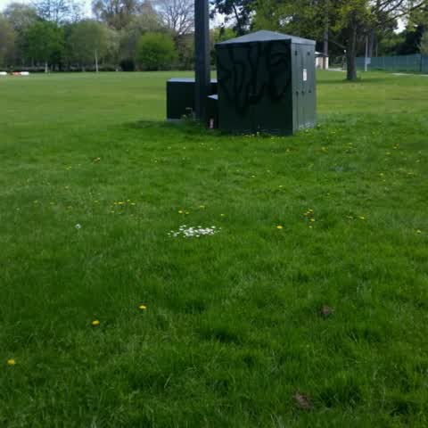
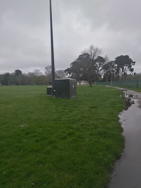
 Graffiti on a fence, building or structure,
on white utility box, dynamix. outside the George hotel
 Graffiti on a fence, building or structure,
on gate, property south of George hotel
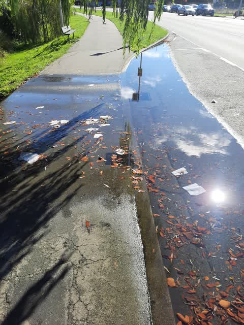
 Street Gutters / Storm Water,
The roading stormwater system in front of the George Hotel on Peterborough Street is blocked again. Water has been pending across the main v
 Graffiti on a fence, building or structure,
More Tag ! As can be seen by my previous snap, send solves, a large length of Park Terrace has been targeted by the taggers. There is a ca
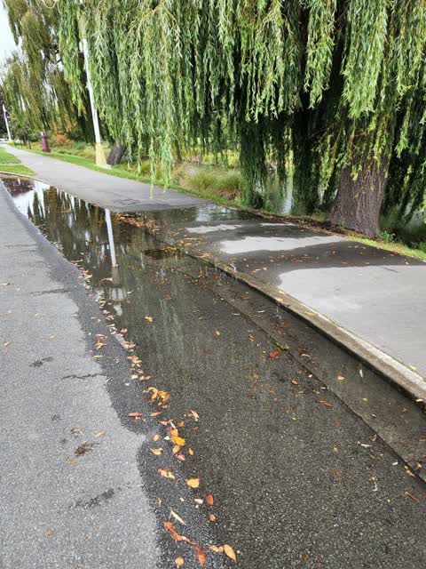
- Street Gutters / Storm Water,
To whom it may concern. There appears to be a street drainage issue at the vehicle entrance to the George Hotel off Peterborough Street. Eit
 Street Gutters / Storm Water,
Gutter blocked or backflowing near 50 Park Terrace.
 General Request,
Graffiti in front of the Cathedral Grammar School
 Graffiti on a fence, building or structure,
Please arrange removal of this tag…
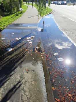 Water Leak,
Seems to be a water leak. Constant flow over the edge
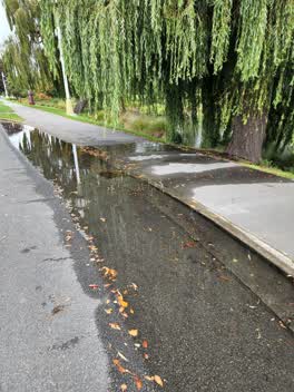 Wastewater/Stormwater,
Storm water drain overflowing in to the Avon, opposite The George
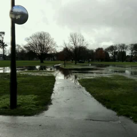
Flooding,
Always covered in a big puddle of water after rain
Graffiti,
Graffiti,
Orion. Hagley Park
Roading/Streets,
Oxford tce in front of the terraces and river and bridge of remb has become a chaotic mess of all day free car parkers congestion and car q
Graffiti,
Power role
Also reported on Park Terrace
- 82A Park Terrace, 59 reports
- 78 Park Terrace, 40 reports
- 34 Park Terrace, 31 reports
- 62 Park Terrace, 29 reports
- 42 Park Terrace, 28 reports
- 82 Park Terrace, 26 reports
- 104 Park Terrace, 25 reports
- 28 Park Terrace, 24 reports
From the air, then
Sourced from Canterbury Maps and partners. LINZ, CC BY 3.0 NZ. Each frame is cut from Environment Canterbury’s historic imagery MapServer for that decade, only where the Footprints layer names a CC BY survey (NZAM-covered spots stay out). RetroLens holds more Crown aerials →
The street’s crash record
NZTA’s record names Park Terrace in 27 crashes that hurt somebody since 2006, 1 person killed, 0 seriously hurt.
The green nearby
- Hagley Park North, you are in it · Sports ground · 91 ha
- Cranmer Square, 182 m to the edge · Botanic · 2 ha
- Armagh Reserve, 242 m to the edge
- Botanic Gardens, 326 m to the edge · Botanic · 21 ha
- Victoria Triangles, 360 m to the edge
Parks within half a kilometre, measured to the boundary, the council’s open data.
The civic shelf nearby
- Aldersgate, 480 m away · Car park
- Armagh Street, 482 m away · Car park
Libraries, halls and the rest within half a kilometre, the council’s open data.
On the doorstep
- 50 Bistro, 46 m away · Restaurants
- The Christchurch Club, 53 m away · Clubs
- The George, 58 m away · Hotels
- The George Hotel, 72 m away · Hotels
Businesses within four hundred metres, measured at the pin: OpenStreetMap and the council directories.
The bus nearby
- Park Tce near Peterborough St, 67 m away · route 8
- Park Tce near Peterborough St, 89 m away · route 8
The closest Metro stops, within four hundred and fifty metres.
The tracks through here
- Walk and bike track through Christchurch Central City, 5 m to the line · walk · bike
- Walk and bike track through Christchurch Central City, 17 m to the line · walk · bike
- Walk and bike track through Christchurch Central City, 35 m to the line · walk · bike
- Walk and bike track through Christchurch Central City, 86 m to the line · walk · bike
- Walk and bike track through Christchurch Central City, 236 m to the line · walk · bike
Tracks whose line passes within half a kilometre, measured to the line itself, the council’s open data.
The named ground
Named water within 500 m of this address, measured to the line or the edge; Named places within 1.5 km of this address; the council’s own structure register, bridges, boardwalks and steps standing nearby, the open map’s record.
The remembered names nearby
- Mischa Kuball / Solidarity Grid, 2015 / Sopot, 5 m away ·
Mischa Kuball / Solidarity Grid, 2015 / SOPOT
· 2013 - Mischa Kuball / Solidarity Grid, 2014 / Wuhan, 15 m away ·
Mischa Kuball / Solidarity Grid, 2014 / WUHAN
· 2013 - Mischa Kuball / Solidarity Grid, 2014 / Songpa, 23 m away ·
Mischa Kuball / Solidarity Grid, 2014 / SONGPA
· 2013
Inscribed plaques within two hundred and fifty metres, the register’s pins, not surveyed spots. The whole roll is at /plaques.
Renting nearby
new bonds in Christchurch Central City ran about $508 a week, $42 below the city median of $550, the suburb page keeps the rent record →.
What was here, Former Christchurch Teachers College and Setting
187 m away · located to ±45 m · the place’s own record →
On the register. Nothing researched here yet.
What was here, Former St Margaret's School Building and Setting
208 m away · 25A Cranmer Square · located to ±24 m · the place’s own record →
On the register. Nothing researched here yet.
What was here, Dwelling and Setting, Ironside House
242 m away · 32 Salisbury Street · located to ±15 m · the place’s own record →
On the register. Nothing researched here yet.
The civic layer
This ground votes in Central ward, the Papanui-Innes-Central community board. Ward lines don’t always follow suburb lines; this one is measured at the pin, not the suburb’s centre.
What stood on this ground → · On the map → · From the air, the Crown’s aerials back to 1936; search the address on RetroLens →
Questions, answered briefly
15 council reports on record since February 2016, most often graffiti on a fence, building or structure (4), street gutters / storm water (3), graffiti (3).
Christchurch Central City, Christchurch, on Park Terrace.
The heritage register names 3 places at or beside it, Former Christchurch Teachers College and Setting, Former St Margaret's School Building and Setting.
Hagley Park North, the address is inside it, 91 ha.