
Waimairi Beach, Christchurch
1,101 council reports since June 2015, the 74th busiest suburb in the city. 906 photographs on record. 1,340 people at the 2023 Census, 1,070 to the square kilometre across 1.3 km².
The record also holds 2023 Census snapshot· 906 photographs· 5 parks· 1 track· 1 name on the map· 2.4% of the outline mapped liquefied· the mapped tsunami reach covers 17% of the outline· ecological sites over 12% of the outline· landscape schedules over 12% of the outline· 573 SCIRT photographs filed on this ground· 0.1 km of cycleway crosses the outline· 3 drawn rules bind this ground· 1 parcels on the dangerous-work register· 41 parcels of made ground· the 2019 model grades this ground mostly possible· 7 council structures on the register· 1 recreation register record· 153 trees on the register· the plan’s word on this ground· 1 epicentre inside the outline· 3 injury crashes· 149 recorded victimisations· 8 bus stops· the council’s fix times· 38 documents· 1 mention on the wire
Live source links
Link-outs to the source’s own live pages, chch.live does not copy their live values or source text.
Living here rent · the ground · the day-to-day
Rent: too few new bonds lodged here for Tenancy Services to publish a median this quarter, the last figure it released was about $725 a week, and it counts this under the “Waimairi Beach” statistical area, close to this suburb’s outline, not exactly it.
Median and quartiles of weekly rents on new private bonds, by quarter. New bonds are fresh lodgements, not the whole rental stock; under five bonds the rent is withheld, and counts are randomly rounded. Source: Tenancy Services rental bond data: provisional while the bond system migrates.
The ground: the February 2011 survey drew liquefaction over 2% of it; the mapped tsunami reach covers 17% of it, the rest of the watch is drawn further down.
Day to day it holds 5 parks, 1 track and 8 bus stops, each is counted further down.
Lately the record’s mostly trees & parks, 139 reports in the year to 14 October 2026, the newest 11 October 2026.
One for the quiz, Its busiest day on record was 21 March 2018, 21 reports in a single day.
2023 Census snapshot SA1 areas grouped here
About 1,293 people and 468 occupied private households in the “Waimairi Beach” statistical area, grouped from 9 SA1 areas. This exact statistical-area match is close to this suburb’s outline, not exactly it.
More of the 2023 Census
- Born overseas19% of stated birthplace
- European ethnicity95% of ethnicity responses
- Māori ethnicity10% of ethnicity responses
- Pacific Peoples ethnicity2% of ethnicity responses
- Asian ethnicity2% of ethnicity responses
- Households with internet92% of stated households
- Households with two or more vehicles74% of stated households
Ethnicity is a multiple-response measure, so those percentages are not meant to add to 100%.
Stats NZ’s 2023 Census uses fixed random rounding to base 3. Unavailable or confidential cells are left out, not treated as zero. individuals · households · geography · CC BY 4.0.
About the suburb
Waimairi Beach is a suburb of Christchurch, New Zealand. It is located north-east of the city. It is east of Parklands and north of North New Brighton. The word "waimairi" translates to "listless stream".
As reported 906 on record
The shape of it outline © OpenStreetMap · recent reports, pinned
The record on Waimairi Beach
- Waimairi Beach enters the written record on 20 December 1920, “NEW BRIGHTON TRUTS. (Grey River Argus, 20 December 1920)”, Papers Past.
- “Waimairi Beach” appears somewhere in 18 of the archive’s records, title, description or body.
- A Papers Past search for the name surfaced 30 records, leads by provenance, not by phrase.
- The first report the feed ever carried here: roading/streets, 6 June 2015, at 105.
- Its busiest day on record was 21 March 2018, 21 reports in a single day.
- The street that keeps coming up is Broadpark Road, reported on 134 separate days.
- For elections the suburb’s centre falls inside Coastal ward, the Coastal-Burwood-Linwood community board is its local layer. The whole roll is at /wards.
Lately the newest reports

Water LeakCanterbury
This has been leaking for a long time now, wonder how many ltrs wasted and they want to charge homeowners for excess water ??


Animal - General1 Torrey Pines
This unregistered red Volvo car belongs to a homeless person who is living in it , along with his cat . The vehicle is parked here 90% of the time. Neighbours…

Dumped RubbishAston Dr


Water Leak9 Aston Dr
Looks like water pipe is about to burst. Leaking under the grass causing a big bulge and water on footpath

Water Leak9 Aston Drive
water leak grass verge mounding up . it's about to blow Actually op no 7 letterbox
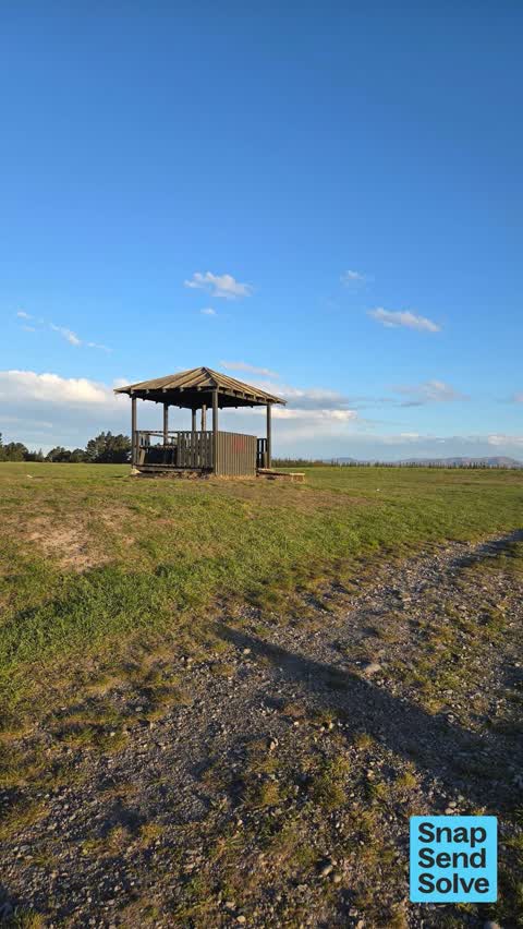
Litter9031 Marine Parade
broken bottles/ glass and cans on trail. on top of hill, next to the shelter. dangerous for dogs paws and bike tyres


Reports per year flat 2024→2025
15
15
16
22
17
44
18
76
19
58
20
54
21
93
22
150
23
133
24
177
25
177
What gets reported
Exactly what people say
How fast the council fixes things here 1,354 finished jobs on record
The median council work order pinned in Waimairi Beach took 5 days to resolve, the city-wide median is 3 days, so this ground runs slower than the city as a whole. The slowest tenth waited 4 months or longer. 69 tickets are open here now, the oldest was filed 21 October 2021.
Work orders, not the resident reports above, the council’s MyCouncilTicket stream, and one job can appear in both. A median counts only finished jobs; open ones are named as open, never averaged in. The ticket roll · the whole city’s fix times.
The suburb today
Schools here
Zoned for Avonside Girls' High School · Christchurch Adventist School · Emmanuel Christian School · Haeata Community Campus · Mairehau High School · Marian College · and 6 more zones, the drawn zone is indicative; the Ministry’s written scheme is the legal boundary.
The green here 5
- Waimairi Beach ParkRegional · 61 ha
- Broad Park2 ha · playground, 109 pieces
- Eastwood Reserve1 ha
- Aston Reserveplayground, 27 pieces
- Sandpiper Reserve
Parks and reserves in the council’s open data, a park lands in the suburb its centre falls inside. The whole roll is at /parks.
The tracks through here 1
- Walk and bike track through Waimairi Beach3.3 km · Christchurch · walk · bike
Tracks in the council’s open data, a line belongs to every suburb it passes through. The whole network is at /tracks.
The names on this ground 1
The February 2011 survey drew mapped ground failure over 2.4% of this outline. A patch is a footprint, not a finding about an address; the count for the whole city is at /liquefaction.
The mapped tsunami extent covers 17% of this outline, about 21 hectares. The sea’s modelled reach, not a prediction, the plan’s inundation line, not the evacuation zones; the share is read from a sampled join. The whole extent is drawn at /tsunami.
1 parcel inside this outline sits on the hazardous-activities register, mostly chemical manufacture, application and bulk storage, 1 still doing the work. A listing records the work, not a soil test; the whole register is drawn at /hazards.
The files record 41 parcels of made or characterised ground inside this outline, about 18 hectares, mostly sand, engineered fill. A record is the file’s word on what was laid, not a fresh survey; the whole layer is drawn at /fill.
The 2019 liquefaction study put 85% of this outline in the possible class. A class is the model’s verdict on a patch of ground, not a finding about an address; the whole study is drawn at /vulnerability.
The council’s structure register stands 7 assets on this ground, 3 boardwalks, 2 shelters, 2 sets of steps, sited at Waimairi Beach Park, Broad Park, Bottle Lake Forest. The register’s site names are its own labels for the ground an asset stands in; the layer is drawn at the map.
The recreation register keeps 1 record inside this outline, bookable surfaces for 1 netball. Seasons and surfaces are the register’s record, not this week’s draw; the layer is drawn at the map.
The register counts 153 living trees inside this outline, 1 carrying a protection, mostly Cabbage tree, Karo, Southern Magnolia. The file remembers 104 trees felled here. A tree record is the register’s word on what stands or stood; the whole canopy is drawn at /trees.
The plan files 37% of this outline under Specific Purpose (Burwood Landfill & Resource Recovery Park), 24% residential, the rest mostly Residential Suburban 24%, Open Space Natural 14%. A zone is a permission, not a description, the mix is read from a sampled join of the plan’s polygons; the whole district is drawn at /zones.
The plan’s ecological schedules cover 12% of this outline, about 15 hectares across 1 scheduled site, all protected under Schedule A. Shares read from a sampled join; a recognition overlay, not a survey. The whole ledger is drawn at /ecology.
The plan’s landscape schedules cover 12% of this outline, about 15 hectares across 4 scheduled areas, and 44% of it sits inside the coastal environment. Shares read from a sampled join; a protection overlay, not a ranking of views. The kept view is drawn at /landscape.
No high-hazard flood area covers this outline. The broader flood-management watch covers 12% of it, Avon River. Shares read from a sampled join; a model’s map, not a promise. The waiting water is drawn at /flood-hazard.
The plan’s water-margin layers cross this outline, and an esplanade line holds a public edge here. The margin is the plan’s drawing, not a survey of the bank; the reaches, strips and held edges are mapped at /water-margin.
The rebuild’s cameras filed 573 photographs on this ground, 2011–2013, wastewater work mostly. Each frame is a receipt the dig left behind, a work log, not a survey of what stands now; the whole record is drawn at /rebuild.
The pedal network threads this ground, 0.1 km of cycleway crosses the outline. A segment counts under every suburb its path enters; the whole network is drawn at /cycleways.
The rulebook binds this ground, 3 drawn instruments, 2 of them dog rules, 1 camping zone, a certified self-contained van can stay the night at City Coastal Restricted Zone; the outline sits inside the takiwā of Te Ngai Tuahuriri Runanga. The bylaw is the instrument, this the map of it, the whole rulebook is drawn at /rules.
GeoNet’s catalogue puts 1 magnitude-3+ epicentre inside this outline since the sequence opened, the biggest a M3.0 in 2011. An epicentre is where the instruments placed the break, not a measure of the shaking here; the whole catalogue is counted at /sequence, the live record is /quakes, and the story in plain language is the earthquakes explainer.
- Burwood MSW Landfillold dump
The named waterways, bays, headlands, monuments, summits and old sites OpenStreetMap puts inside this outline, a pin is the mapper’s own; a waterway belongs to every suburb it crosses. Every roll, counted: /geography.
The crash record 3 injury crashes
3 crashes that hurt somebody on record inside Waimairi Beach's outline, 0 seriously hurt, nobody killed.
The corner that keeps appearing: Aston Drive at Ballance Street, 1 injury crash.
The crime record 149 recorded victimisations
149 victimisations on the Police record inside Waimairi Beach’s outline, September 2022–August 2026, mostly theft, about 29 a year per 1,000 residents. Up 13% on the year before. Reported is not all, how much never reaches the record depends on the offence.
The buses through it 8 stops
8 Metro stops inside Waimairi Beach's outline, in ECan’s stop record, served by route 80.
- Aston Dr near Ballance St
- Aston Dr near Beach Rd near Aston Dr
- Aston Dr near Beach Rd near Aston Dr
- Aston Dr near Orlando Cres
- Aston Dr near Torres Pines near Aston Dr
- Aston Dr near Torres Pines near Aston Dr
- North Shore near Aston Dr
- North Shore near Aston Dr
Before any of that
Documents 38
What the archive’s sources say about Waimairi Beach, titled for it, turned up by a search for one of its places, or carrying its name in the text. These are leads and citations: the originals live at the provider, linked from each row.
71920s
121930s
131940s
2000s
52010s
NEW BRIGHTON TRUTS. (Grey River Argus, 20 December 1920)Grey River Argus · Papers Past · National Library of New Zealand · · text held
TROTTING (Evening Post, 18 December 1922)Evening Post · Papers Past · National Library of New Zealand · · text held
TROTTING. (Hawera & Normanby Star, 18 December 1923)Hawera & Normanby Star · Papers Past · National Library of New Zealand · · text held
NEW BRIGHTON MEETING (Evening Post, 18 December 1923)Evening Post · Papers Past · National Library of New Zealand · · text held
TROTTING (Evening Post, 18 December 1928)Evening Post · Papers Past · National Library of New Zealand · · text held
BODIES RECOVERED (Evening Post, 03 March 1930)
…night were found during the week-end the body of hurtle fisher was found yesterday on the waimairi beach and john meuaghan body was washed up this morning on a spit at the mouth of the avaimakariri ri…Evening Post · Papers Past · National Library of New Zealand · · text held
NEW BRIGHTON REHANDICAPS (Evening Post, 19 January 1931)Evening Post · Papers Past · National Library of New Zealand · · text held
NEW BRIGHTON TROTS (Evening Post, 09 October 1931)Evening Post · Papers Past · National Library of New Zealand · · text held
N.Z. GOLF COUNCIL (Evening Post, 05 April 1933)
…evedon golf club clevedon auckland north end golf club timaru pahiatua golf club pahiatua waimairi beach golf club christchurch letters were received from the new south wales golf council and the vict…Evening Post · Papers Past · National Library of New Zealand · · text held
NEW BRIGHTON TROTS (Evening Post, 25 September 1934)Evening Post · Papers Past · National Library of New Zealand · · text held
The rest are a search away, the whole shelf, for the name →
The wire on Waimairi Beach 1 lately
Tōrea (South Island Pied Oystercatcher) seen — Waimairi Beach, Christchurch 8083, New ZealandiNaturalist · urewerawhio ·
Next door
Compare Waimairi Beach with North New Brighton · Parklands · New Brighton · Burwood · Avondale · Bottle Lake, same record, side by side.
Questions, answered briefly
What is Waimairi Beach?
Waimairi Beach is a suburb of Christchurch, New Zealand. The public record holds 1,101 council reports for it, the first filed in June 2015.
How many people live in Waimairi Beach?
1,340 people at the 2023 Census, 1,070 per square kilometre across 1.3 km².
How many people does the 2023 Census count for Waimairi Beach?
About 1,293 people and 468 occupied private households: grouped from Stats NZ SA1 areas through this site’s suburb join. Indicative, not a LIM.
What gets reported in Waimairi Beach?
1,101 reports on record, most often trees & parks (328), rubbish & dumping (234), roads & footpaths (155). 139 of them in the year to 14 October 2026.
How many crashes has Waimairi Beach had?
3 injury crashes on the police record inside the suburb’s outline, 0 seriously hurt, nobody killed. The suburb’s crashes, mapped →
Did earthquakes strike under Waimairi Beach?
GeoNet’s catalogue puts 1 magnitude-3+ epicentre inside the suburb’s mapped outline since the September 2010 mainshock, the biggest a M3.0 in 2011. An epicentre is where the instruments placed the break, not a measure of the shaking felt here. The whole sequence, counted → · The story, in plain language →
Every suburb in Christchurch → · Its decade, charted → · the whole A–Z →