The school’s own register
One school keeps eleven entries on the roll, Christ’s College’s chapel, houses, classrooms, halls and library each listed separately along Rolleston Avenue. The walk is a campus tour, ending at the memorial chapel across the river. Flat and short.
The walk, as a line
Straight between pins, the streets run longer. Every numbered pin opens that place’s own record.
The stops, in order
- Christ's College Open Air Classrooms and Setting, 33I Rolleston Avenue · Heritage NZ list 3282 · 27 unread leads
The open-air classrooms, the school’s most unusual listing, first on the walk.
- Christ's College Former Big School and Setting, 33R Rolleston Avenue · Heritage NZ list 48 · 37 unread leads · a Wikipedia entry
Big School, the former main classroom block.
- Christ's College Former Condell's House and Setting, 33U Rolleston Avenue · Heritage NZ list 4913 · 21 unread leads
Condell’s House, the first of the boarding houses.
- Christ's College School House and Setting, 33A Rolleston Avenue · Heritage NZ list 3280 · 41 unread leads
School House.
- Christ's College Former Hare Memorial Library and Classrooms and Setting, 33H Rolleston Avenue · Heritage NZ list 3278 · 21 unread leads
The Hare Memorial Library, built as a memorial, like the dining hall to come.
- Christ's College Chapel and Setting, 33G Rolleston Avenue · Heritage NZ list 3277 · 38 unread leads · a Wikipedia entry
The chapel, the school’s own entry among the city’s churches.
- Christ's College Jacobs House and Setting, 33K Rolleston Avenue · Heritage NZ list 3279 · 40 unread leads
Jacobs House.
- Christ's College Former New Classrooms and Setting, 33 Rolleston Avenue · 29 unread leads
The former new classrooms, "new" only in the listing’s name.
- Christ's College Dining Hall Tower and Hospital and Setting, 33 Rolleston Avenue · 33 unread leads
The dining hall tower, the tower and the hospital in one entry.
- Christ's College Memorial Dining Hall and Setting, 33J Rolleston Avenue · Heritage NZ list 3276 · 38 unread leads
The Memorial Dining Hall, the school’s war memorial you can eat in.
- Christ's College Administration Building and Setting, 33Q Rolleston Avenue · 40 unread leads
The administration building, the last of the school’s own eleven.
- College Hall and Setting, 50 Rolleston Avenue · 44 unread leads
College Hall on Rolleston Avenue, a step beyond the school gate.
- Nurses' Memorial Chapel and Setting, 2J Riccarton Avenue · Heritage NZ list 1851 · 40 unread leads · a Wikipedia entry
The Nurses' Memorial Chapel, across the river, the walk’s last memorial.
What the register built on the way
Council structures within about 30 m of the stop-to-stop line, the bridges, steps and shelters the route passes. Site names are the register’s own.
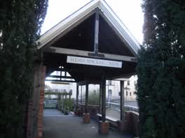 A shelter at Nurses Memorial Chapel, built 1999
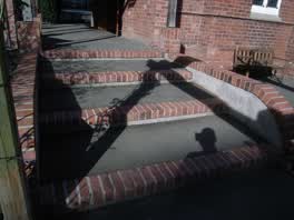 A set of steps at Nurses Memorial Chapel, 4 m long · built 1999 7 m off the line
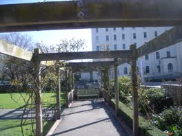 A shelter at Nurses Memorial Chapel, built 1999 10 m off the line
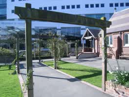 A shelter at Nurses Memorial Chapel, built 1999 12 m off the line
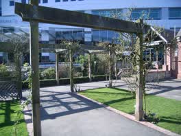 A shelter at Nurses Memorial Chapel, built 1999 12 m off the line
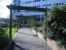 A shelter at Nurses Memorial Chapel, built 1999 13 m off the line
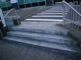 A set of steps at Nurses Memorial Chapel, 2 m long · built 1999 15 m off the line
- A jetty 26 m off the line
The reports along it
1,996 council reports pinned within 150 m of the line, most often Graffiti & vandalism and Roads & footpaths, 1,508 with a photograph. A pin is where a reporter stood, not a claim about the place itself.
 Pavement - Damaged
 Graffiti on a traffic light pole or cabinet, or wa
 Graffiti on a bus stop or public toilet
 Graffiti on a road, footpath or bridge
 Graffiti on a fence, building or structure
 Street Gutters / Storm Water
 Graffiti on a sign, mural or public art
 Traffic Signals
 Graffiti on a traffic light pole or cabinet, or wa
 Graffiti on a fence, building or structure
 Graffiti on a fence, building or structure
 Hazard, vehicle
Questions, answered briefly
One school keeps eleven entries on the roll, Christ’s College’s chapel, houses, classrooms, halls and library each listed separately along Rolleston Avenue. 13 listed places, 1.1 km as the line runs, Christchurch Central City.
Christ's College Open Air Classrooms and Setting (33I Rolleston Avenue) to Nurses' Memorial Chapel and Setting (2J Riccarton Avenue), the order is a suggestion, not the only way round.
Every one, each pin is a row in the district plan’s heritage schedule, and each opens the place’s own sourced record here.
1.1 km measured straight between the pins, the streets run longer, and the stops deserve a pause each.
The record behind this
Every stop is a row in the district plan’s heritage schedule, held here as the register’s own layer. The order and the notes are ours, the listings are the council’s and Heritage New Zealand’s. "Setting" is the register’s word for the ground a listing covers.
The rest of the register here: Central City
The same ground today: Christchurch Central City
More walks over this ground: The square and its ring · The boulevard · The river bend
This page as markdown: /walks/christs-college.md · the route as data: /walks/christs-college.geojson · on the live map: the walks layer.