250 Kilmore Street, Christchurch Central City
18 reports on record since July 2015 · 13 with photographs. The street’s heaviest record is 70 Kilmore Street — 86 reports on file. Indicative rating valuation and school zones, hazards, bin day and what stood here before.
What gets reported here
Photographed here 13 on record


Reported here
 Water Leak —
water leak. thank you!
 Graffiti on a fence, building or structure —
Street light. Thank you!
 Graffiti on a fence, building or structure —
Thank you!
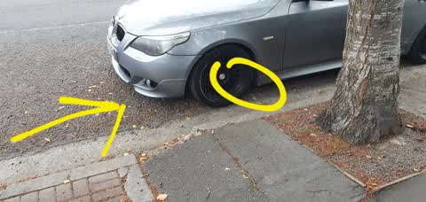
 Hazard — vehicle —
Cars are constantly parked on this intersection blocking vision to left and creating a hazard. It needs to be fixed with a physical barrier
 Dumped Rubbish —
 Hazard — vehicle —
Yes another car causing a safety hasad at corner of Kilmore and Dawson. This intersection needs bollards to keep the link of sight clear.
 Graffiti —
- Hazard — vehicle —
- Pavement - General —
- Graffiti —
- Rubbish and Bins - General —
- Graffiti —
 Graffiti —
254 kilmore
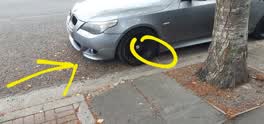 Roading/Streets —
White parking lines need repainting. Cars parking way to close to Dawson Street exit obstructing view. Will cause death as you cant see on c
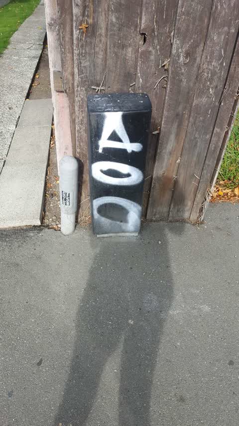
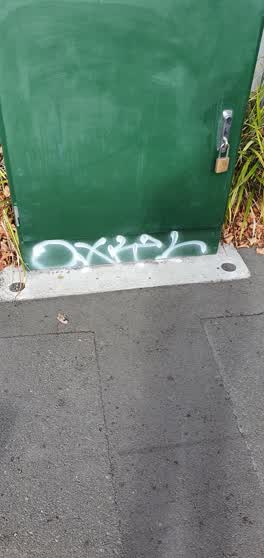 Graffiti —
graffiti
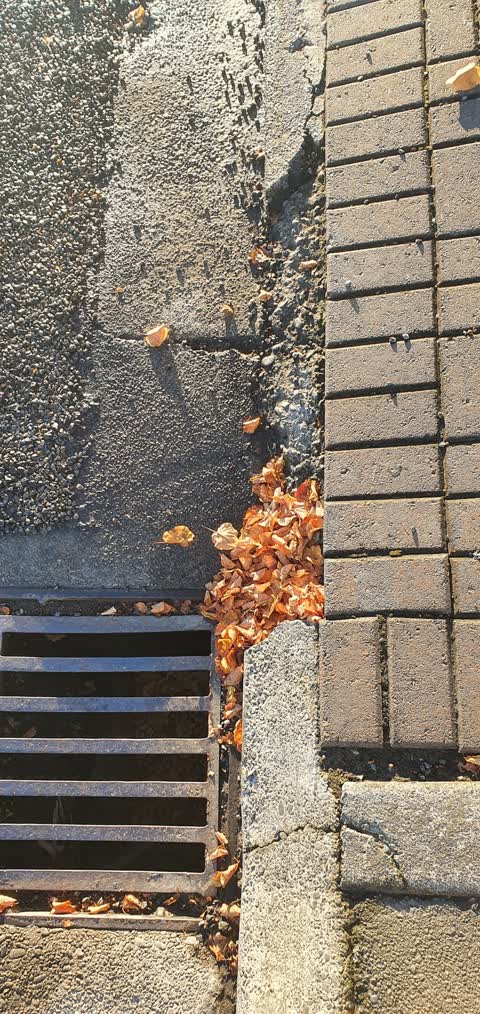
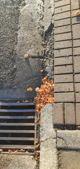 Roading/Streets —
kerb/channel broken...
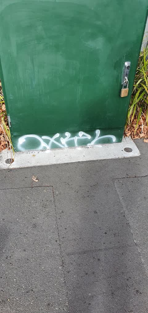
Graffiti —
Graffiti —
on green box
Also reported on Kilmore Street
- 70 Kilmore Street — 86 reports
- 211 Kilmore Street — 72 reports
- 294E Kilmore Street — 53 reports
- 277 Kilmore Street — 49 reports
- 254 Kilmore Street — 42 reports
- 86 Kilmore Street — 30 reports
- 284 Kilmore Street — 29 reports
- 229 Kilmore Street — 28 reports
The street’s crash record
NZTA’s record names Kilmore Street in 104 crashes that hurt somebody since 2006 — 1 person killed, 22 seriously hurt.
The green nearby
- Chester Street East Reserve — 119 m to the edge
- Walnut Tree Park — 185 m to the edge
- Avon Riverbank Central City — 198 m to the edge · 6 ha
- Cambridge Green — 219 m to the edge
- William Brittan — 272 m to the edge
Parks within half a kilometre, measured to the boundary — the council’s open data.
On the doorstep
- Advanced Ceramics — 89 m away · Dentists
- Boteco — 102 m away · Cafés
- Christchurch Bridge Club — 103 m away · Clubs
- Boteco Cafe & Restaurant — 106 m away · Restaurants
Businesses within four hundred metres, measured at the pin — OpenStreetMap and the council directories.
The bus nearby
- Fitzgerald Ave near Armagh St — 289 m away · route 7
- Fitzgerald Ave near Avonside Dr — 290 m away · route 7
The closest Metro stops, within four hundred and fifty metres.
The tracks through here
- Walk and bike track through Christchurch Central City — 10 m to the line · walk · bike
- Walk and bike track through Christchurch Central City — 200 m to the line · walk · bike
- Walk and bike track through Christchurch Central City — 231 m to the line · walk · bike
- Walk and bike track through Christchurch Central City — 232 m to the line · walk · bike
- Walk and bike track through Christchurch Central City — 237 m to the line · walk · bike
Tracks whose line passes within half a kilometre, measured to the line itself — the council’s open data.
The named ground
Named water within 500 m of this address, measured to the line or the edge; Named places within 1.5 km of this address; the council’s own structure register — bridges, boardwalks and steps standing nearby — the open map’s record.
The remembered names nearby
- This Cairn / Marks the Site / of the / Brick Wharf — 216 m away ·
THIS CAIRN / MARKS THE SITE / OF THE / BRICK WHARF / WHERE THE / EARLY SETTLER / LANDED 18
- Plaque no. 310899 — 246 m away
- Plaque no. 310900 — 246 m away
Inscribed plaques within two hundred and fifty metres — the register’s pins, not surveyed spots. The whole roll is at /plaques.
Renting nearby
new bonds in Christchurch Central City ran about $508 a week — $42 below the city median of $550 — the suburb page keeps the rent record →.
What was here — Dwelling and Setting
on this spot · 250 Kilmore Street · located to ±8 m · the place’s own record →
On the register. Nothing researched here yet.
What was here — Commercial Building and Setting
127 m away · 228 Kilmore Street · located to ±11 m · the place’s own record →
On the register. Nothing researched here yet.
What was here — Former Maturing Cellars and Administration Offices and Setting
197 m away · 294 Kilmore Street · located to ±24 m · the place’s own record →
On the register. Nothing researched here yet.
What was here — The Bricks Site, Cairn and Setting
220 m away · 311 Oxford Terrace · located to ±35 m · the place’s own record →
On the register. Nothing researched here yet.
What was here — Former Boiler House and Setting
220 m away · 175 Chester Street East · located to ±10 m · the place’s own record →
On the register. Nothing researched here yet.
The civic layer
This ground votes in Central ward — the Papanui-Innes-Central community board. Ward lines don’t always follow suburb lines; this one is measured at the pin, not the suburb’s centre.
What stood on this ground → · On the map → · From the air — the Crown’s aerials back to 1936; search the address on RetroLens →
Questions, answered briefly
18 council reports on record since July 2015 — most often graffiti (7), hazard — vehicle (3), roading/streets (2).
Christchurch Central City, Christchurch — on Kilmore Street.
The heritage register names 5 places at or beside it — Dwelling and Setting, Commercial Building and Setting.
Chester Street East Reserve — 119 m to its edge.