86 Kilmore Street, Christchurch Central City
30 reports on record since March 2020 · 23 with photographs. The street’s heaviest record is 70 Kilmore Street, 86 reports on file. Indicative rating valuation and school zones, hazards, bin day and what stood here before.
What gets reported here
Photographed here 23 on record






Reported here
 Graffiti on a playground or in a park,
tags
 Dumped Rubbish,
rubbish,
 Graffiti on a fence, building or structure,
Graffiti Across the Side Of the building
 Graffiti on a fence, building or structure,
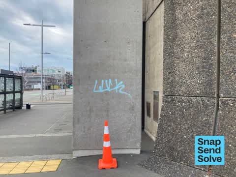
Tagging ‘luck’ in light blue paint on Town Hall column behind bus stop on Kilmore street
 Graffiti on a sign, mural or public art,
I noticed graffiti all along the fence line and on the back of a couple of signs right opposite the town hall....
 Graffiti on a sign, mural or public art,
Here is tagging on the sign by the wooden archways...
 Park - General Request,
copper or brass hand rails removed. hopefully they've not been stolen...
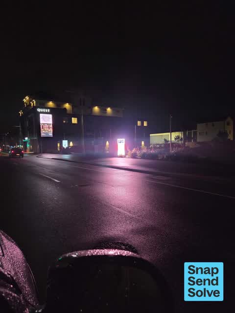
 Road Signage,
that sign is way to bright at night
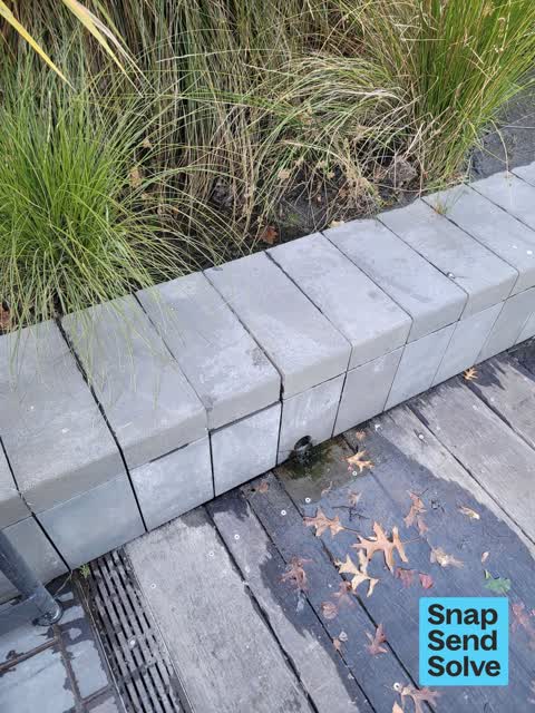
 Water General,
thinks it might be leaking irrigation. but could be a spring..?
 Overgrown Vegetation,
Some
 Graffiti on a fence, building or structure,
 Vandalism - General,
Dishwash soap in ferrier fountain
 Graffiti on a fence, building or structure,
Tagging on lamp on outside wall of Christchurch Town Hall (across river from Waka wharf). Access via Colombo Dock driveway.
 Vandalism - General,
 Park - General Request,
River backwash needs minor redesign to flush gunk.
- Graffiti,
- Facility - General Request,
- Poles and Signage - General,
- Road Signage,
- Water General,
- Graffiti,
- Facility - General Request,
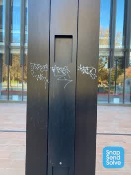 Graffiti,
Steps outside town hall by fountain
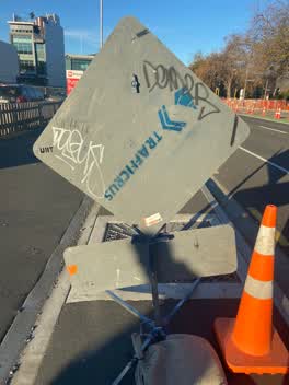 Graffiti,
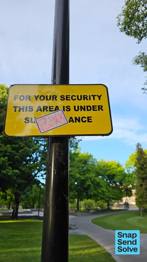
Black and white paint tags on reverse side of road sign on Kilmore Street opposite the town hall.
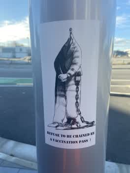 Graffiti,
Anti vax misinformation sticky tags on steel floodlight pole on Kilmore Street by town hall west of Colombo Street need removal.
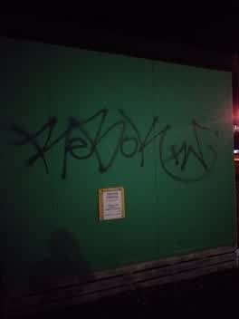 Graffiti,
Old pavilion toilets (the comms public toilet)
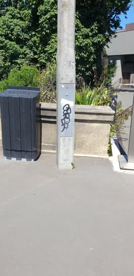 Graffiti,
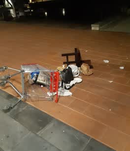 Graffiti,
(Matthew Thomas from Armourguard) at the rear of the town hall there is a warehouse trolley with rubbish and broken plates.
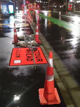 Roading/Streets,
For CTOC TTM sign bases placed by Fulton Hogan on footpath without signs attached (although signs and stands have been carefully placed on g
Parks,
The tree is behind the Town Hall, across from the Floral Clock. The branch has fallen across a pathway. Health and safety issue.
Also reported on Kilmore Street
- 70 Kilmore Street, 86 reports
- 211 Kilmore Street, 72 reports
- 294E Kilmore Street, 53 reports
- 277 Kilmore Street, 49 reports
- 254 Kilmore Street, 42 reports
- 284 Kilmore Street, 31 reports
- 229 Kilmore Street, 28 reports
- 296 Kilmore Street, 27 reports
From the air, then
Sourced from Canterbury Maps and partners. LINZ, CC BY 3.0 NZ. Each frame is cut from Environment Canterbury’s historic imagery MapServer for that decade, only where the Footprints layer names a CC BY survey (NZAM-covered spots stay out). RetroLens holds more Crown aerials →
The street’s crash record
NZTA’s record names Kilmore Street in 105 crashes that hurt somebody since 2006, 1 person killed, 23 seriously hurt.
The green nearby
- Victoria Square, 47 m to the edge · Botanic · 2 ha
- Edmonds Band Rotunda, 197 m to the edge · Botanic
- Canterbury Provincial Council Reserve, 207 m to the edge · Botanic
- Victoria Triangles, 293 m to the edge
- Cathedral Square, 376 m to the edge · Botanic
Parks within half a kilometre, measured to the boundary, the council’s open data.
The civic shelf nearby
- Aldersgate, 227 m away · Car park
- Armagh Street, 278 m away · Car park
- Turanga Library, 348 m away · Library · Cathedral Square, Christchurch
Libraries, halls and the rest within half a kilometre, the council’s open data.
On the doorstep
- Christchurch Town Hall, 26 m away · Venues & events
- Ko Tāne, 104 m away · Attractions
- Krung Thep Thai Street Food, 105 m away · Restaurants
- Quest on Kilmore, 109 m away · Hotels
Businesses within four hundred metres, measured at the pin: OpenStreetMap and the council directories.
The bus nearby
- Kilmore Street Town Hall, 81 m away · route 1, route 29, route 95
- Kilmore St near Manchester St, 193 m away · route 1, route 27, route 29, route 95
The closest Metro stops, within four hundred and fifty metres.
The tracks through here
- Walk and bike track through Christchurch Central City, 179 m to the line · walk · bike
- Walk and bike track through Christchurch Central City, 188 m to the line · walk · bike
- Walk and bike track through Christchurch Central City, 190 m to the line · walk · bike
- Walk and bike track through Christchurch Central City, 308 m to the line · walk · bike
- Walk and bike track through Christchurch Central City, 324 m to the line · walk · bike
Tracks whose line passes within half a kilometre, measured to the line itself, the council’s open data.
The named ground
Named water within 500 m of this address, measured to the line or the edge; Named places within 1.5 km of this address; the council’s own structure register, bridges, boardwalks and steps standing nearby, the open map’s record.
The remembered names nearby
- He Poupou Tohu Ahi-Kä o Ngäi Tahu, 60 m away ·
He poupou tohu ahi-kÄ o NgÄi Tahu / A mark of the long burning fires of NgÄi Tahu
· 2018 - The Hamish Hay Bridge, 84 m away ·
THE HAMISH HAY BRIDGE / This historic bridge was renamed by the Christchurch City Council
· 2018 - Trams Across the Bridge / the Rails Below Commemorate, 84 m away ·
TRAMS ACROSS THE BRIDGE / THE RAILS BELOW COMMEMORATE / 74 YEARS OF PUBLIC TRAM SERVICES /
· 2018
Inscribed plaques within two hundred and fifty metres, the register’s pins, not surveyed spots. The whole roll is at /plaques.
Renting nearby
new bonds in Christchurch Central City ran about $508 a week, $42 below the city median of $550, the suburb page keeps the rent record →.
What was here, The Christchurch Town Hall and Setting
on this spot · located to ±79 m · the place’s own record →
On the register. Nothing researched here yet.
What was here, Colombo Street Bridge and Setting
67 m away · located to ±24 m · the place’s own record →
On the register. Nothing researched here yet.
What was here, Former Market Place Bridge/Hamish Hay Bridge and Setting
82 m away · located to ±31 m · the place’s own record →
On the register. Nothing researched here yet.
What was here, Captain James Cook Statue and Setting
97 m away · 89 Armagh Street · located to ±2 m · the place’s own record →
On the register. Nothing researched here yet.
What was here, Bowker Fountain and Setting
99 m away · located to ±13 m · the place’s own record →
On the register. Nothing researched here yet.
The civic layer
This ground votes in Central ward, the Papanui-Innes-Central community board. Ward lines don’t always follow suburb lines; this one is measured at the pin, not the suburb’s centre.
What stood on this ground → · On the map → · From the air, the Crown’s aerials back to 1936; search the address on RetroLens →
Questions, answered briefly
30 council reports on record since March 2020, most often graffiti (8), graffiti on a fence, building or structure (4), water general (2).
Christchurch Central City, Christchurch, on Kilmore Street.
The heritage register names 5 places at or beside it, The Christchurch Town Hall and Setting, Colombo Street Bridge and Setting.
Victoria Square, 47 m to its edge, 2 ha.