211 Kilmore Street, Christchurch Central City
72 reports on record since March 2019 · 54 with photographs. The street’s heaviest record is 70 Kilmore Street — 86 reports on file. Indicative rating valuation and school zones, hazards, bin day and what stood here before.
What gets reported here
Photographed here 54 on record


Reported here
 General Request —
 Graffiti on utility box.
 Graffiti on a traffic light pole or cabinet, or wa —
 graffiti on traffic control cabinet nearby
 Graffiti on a fence, building or structure —
 graffiti on light lamp post pole
 Graffiti on a traffic light pole or cabinet, or wa —
 graffiti on traffic control cabinet
 Graffiti on a traffic light pole or cabinet, or wa —
 North East intersection of Madras St and Kilmore St black spray graffiti on light blue traffic control cabinet
 Graffiti on a road, footpath or bridge —
 graffiti on side of bridge near Orion cabinet just along
 Dumped Rubbish —
 North East intersection of Kilmour & Madras Street: three road cones (identification : McDowell WM, Nova) Dumped on the footpath
 Graffiti on a traffic light pole or cabinet, or wa —
 North 3ast intersection Madras & Kilmore St: blue marker graffiti on light blue traffic control cabinet
 Graffiti on a traffic light pole or cabinet, or wa —
 North East intersection of Madras St and Kilmore St: black marker graffiti on light blue traffic light control cabinet
 Graffiti on a fence, building or structure —
 graffiti on light lamp post pole this corner
 Graffiti on a road, footpath or bridge —
 graffiti tag stickers on the Northside east end of kilmore St bridge
 Graffiti on a fence, building or structure —
 Graffiti on Northside of kilmore st bridge
 Graffiti on a traffic light pole or cabinet, or wa —
 Traffic control cabinet on corner
 Graffiti somewhere else —
  Graffiti somewhere else —
 Graffiti needs fixing
 Graffiti on a cabinet, pole or railway asset —
  Graffiti somewhere else —
 Graffiti on kilmore bridge railings
 Graffiti somewhere else —
 Graffiti on Orion cabinet north west side of kilmore bridge
 General Request —
 Just wondering why and how long this fencing will be up for on the public berm? The grass nearby and within the fence has not been mowed for
 Graffiti on a fence, building or structure —
  Graffiti on a fence, building or structure —
  Graffiti on a cabinet, pole or railway asset —
 Multiple paint tags on traffic controller by 211 Kilmore Street corner of Madras Street.
 Graffiti on a road, footpath or bridge —
  Graffiti on a cabinet, pole or railway asset —
  Graffiti on a cabinet, pole or railway asset —
 Graffiti on cabinet. Near corner of Madras St and Kilmore St.
 Graffiti on a cabinet, pole or railway asset —
 Graffiti on green cabinet. Beside Kilmore St bridge.
 Graffiti on a cabinet, pole or railway asset —
 Graffiti on grey cabinet Corner Madras St and Kilmore St
 Graffiti on a fence, building or structure —
  Graffiti on a fence, building or structure —
 White paint tag on north side top rail of the Kilmore Street bridge on the Avon River.
 Graffiti on a fence, building or structure —
  Graffiti on a cabinet, pole or railway asset —
  Fallen Tree —
 Cambridge tce North side of Kilmore Street Bridge.Fallen tree that will end in the river eventually causing blockage
 Graffiti on a fence, building or structure —
 KAEPE white paint tag on wooden pole at the corner of Madras and Kilmore Streets.
 Graffiti —
 Yellow graffiti on green communication box. Corner of Kilmore St and Madras St.
 Graffiti —
  General Request —
 - Road Blockage —
traffic management at kilmore/madras have not left space for cyclists when narrowing to 1 lane. the area required for work does not require
- Trees - General —
- Graffiti —
- Graffiti —
- Graffiti —
- Graffiti —
- Overgrown Vegetation —
- Pavement - Damaged —
- Graffiti —
- Graffiti —
- Park - General Request —
- Hazard — vehicle —
- Graffiti —
- Graffiti —
- Dumped Rubbish —
- Graffiti —
- Graffiti —
- Graffiti —
 Graffiti —
  Graffiti —
 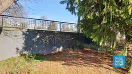 Graffiti —
 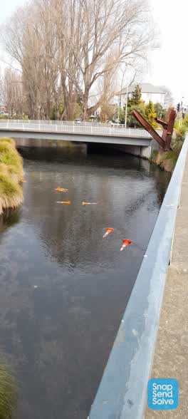 Parks —
 Cones in river
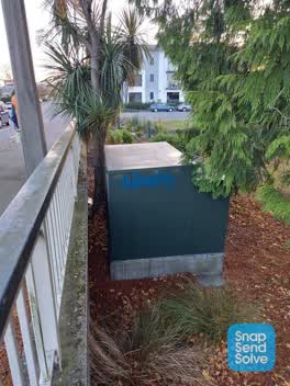 Graffiti —
 Tagging on large Orion box to side of river bridge on Kilmore St, near Madras St
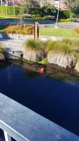 Rubbish/Recycling —
 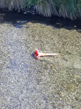 General Request —
 Road cone dumped in Avon river.
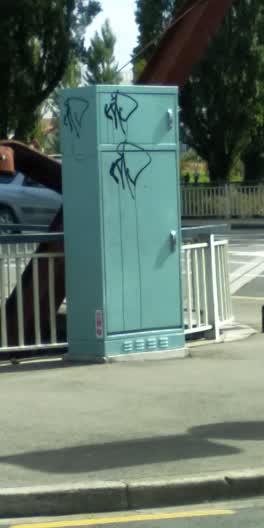 Graffiti —
 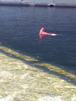 Roading/Streets —
 Road cone thrown into Avon river off Kilmore St bridge.
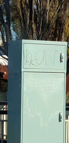 Graffiti —
 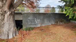 Graffiti —
 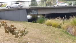 Graffiti —
 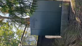 Graffiti —
 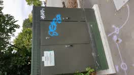 Graffiti —
 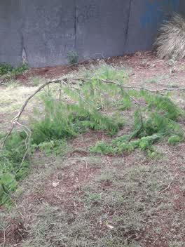 Parks —
 broken tree branch
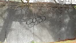 Graffiti —
 Graffiti —
Madas and Gilmore bridge
Graffiti —
Also reported on Kilmore Street
- 70 Kilmore Street — 86 reports
- 294E Kilmore Street — 53 reports
- 277 Kilmore Street — 49 reports
- 254 Kilmore Street — 42 reports
- 86 Kilmore Street — 30 reports
- 284 Kilmore Street — 29 reports
- 229 Kilmore Street — 28 reports
- 296 Kilmore Street — 27 reports
The street’s crash record
NZTA’s record names Kilmore Street in 104 crashes that hurt somebody since 2006 — 1 person killed, 22 seriously hurt.
The green nearby
- Fire Fighters Reserve — 32 m to the edge
- Cambridge Reserve — 45 m to the edge
- Poplars Reserve — 78 m to the edge · Botanic
- Avon Riverbank Central City — 263 m to the edge · 6 ha
- Cambridge Green — 274 m to the edge
Parks within half a kilometre, measured to the boundary — the council’s open data.
On the doorstep
- Pillars Cafe — 83 m away · Cafés
- Foley Towers — 148 m away · Hostels
- Fox and Associates — 152 m away · Surveyors
- South Architects — 156 m away · Architects
Businesses within four hundred metres, measured at the pin — OpenStreetMap and the council directories.
The bus nearby
- Manchester St near Kilmore St — 264 m away · route 1, route 27, route 29, route 44, route 91, route 92, route 95
- Manchester St near Kilmore St — 272 m away · route 44, route 91, route 92
The closest Metro stops, within four hundred and fifty metres.
The tracks through here
- Walk and bike track through Christchurch Central City — 11 m to the line · walk · bike
- Walk and bike track through Christchurch Central City — 12 m to the line · walk · bike
- Walk and bike track through Christchurch Central City — 39 m to the line · walk · bike
- Walk and bike track through Christchurch Central City — 51 m to the line · walk · bike
- Walk and bike track through Christchurch Central City — 61 m to the line · walk · bike
Tracks whose line passes within half a kilometre, measured to the line itself — the council’s open data.
The named ground
Named water within 500 m of this address, measured to the line or the edge; Named places within 1.5 km of this address; the council’s own structure register — bridges, boardwalks and steps standing nearby — the open map’s record.
The remembered names nearby
- A Tribute to Firefighters Sculpture by Graham Bennett Steel — 33 m away ·
A Tribute to Firefighters Sculpture by Graham Bennett Steel from the New York World Trade
· 2009 - Lion Foundation a Gaming Machine Charitable Trust Belfast — 34 m away ·
LION FOUNDATION A GAMING MACHINE CHARITABLE TRUST Belfast Tavern; Bush Inn Hotel; Halswell
· 2009 - Christchurch City Council Acknowledges Generous Support — 35 m away ·
Christchurch City Council acknowledges generous support of sponsors (full list engraved)
· 2009
Inscribed plaques within two hundred and fifty metres — the register’s pins, not surveyed spots. The whole roll is at /plaques.
Renting nearby
new bonds in Christchurch Central City ran about $508 a week — $42 below the city median of $550 — the suburb page keeps the rent record →.
What was here — Edmonds Clock Tower, Telephone Cabinet and Setting
128 m away · 295F Madras Street · located to ±15 m · the place’s own record →
On the register. Nothing researched here yet.
What was here — Dwellings and Setting
164 m away · 86 Chester Street East · located to ±15 m · the place’s own record →
On the register. Nothing researched here yet.
What was here — Dwellings and Setting
166 m away · 100 Chester Street East · located to ±13 m · the place’s own record →
On the register. Nothing researched here yet.
What was here — Poplars, Lamp Standards and Setting
188 m away · located to ±139 m · the place’s own record →
On the register. Nothing researched here yet.
What was here — Former Vicarage of the Church of St Luke the Evangelist and Setting
191 m away · 185 Kilmore Street · located to ±12 m · the place’s own record →
On the register. Nothing researched here yet.
The civic layer
This ground votes in Central ward — the Papanui-Innes-Central community board. Ward lines don’t always follow suburb lines; this one is measured at the pin, not the suburb’s centre.
What stood on this ground → · On the map → · From the air — the Crown’s aerials back to 1936; search the address on RetroLens →
Questions, answered briefly
72 council reports on record since March 2019 — most often graffiti (26), graffiti on a fence, building or structure (9), graffiti on a cabinet, pole or railway asset (7).
Christchurch Central City, Christchurch — on Kilmore Street.
The heritage register names 5 places at or beside it — Edmonds Clock Tower, Telephone Cabinet and Setting, Dwellings and Setting.
Fire Fighters Reserve — 32 m to its edge.