296 Kilmore Street, Christchurch Central City
27 reports on record since February 2019 · 12 with photographs. The street’s heaviest record is 70 Kilmore Street — 86 reports on file. Indicative rating valuation and school zones, hazards, bin day and what stood here before.
What gets reported here
- Graffiti — 10
- Vandalism - General — 2
- Roading/Streets — 2
- Pavement - General — 2
- Pavement - Damaged — 2
- Roads - General — 1
Photographed here 12 on record


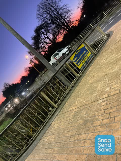
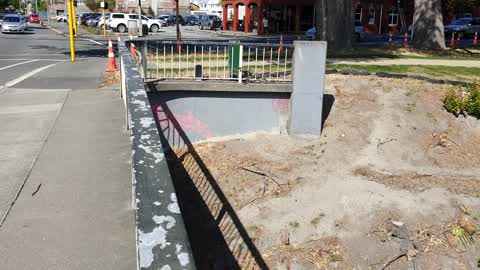
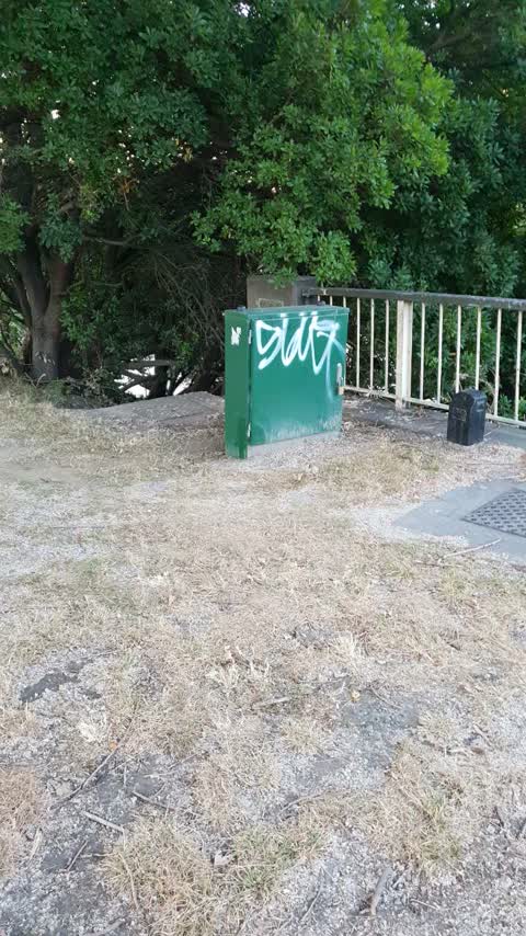
Reported here
 Graffiti on a sign, mural or public art —
Graffiti on a sign
 Road Signage —
Kilmore Street and Moorhouse Avenue need signs at their intersection.
 Pavement - General —
Post lifted from original location. Attatched to cable. No longer protection of landscaped area. Thanks.
 Graffiti on a traffic light pole or cabinet, or wa —
Traffic control cabinet
 Pavement - General —
Please put extra gravel and make riverside ending higher so it stays there. The black rubber things have become a trip hazard
- Vandalism - General —
Multiple tags on blue traffic light box
 Graffiti somewhere else —
 Graffiti on a cabinet, pole or railway asset —
Corner Kilmore and Fitzgerald by Pomeroy's
 Pavement - Damaged —
Potholes path surrounding old concrete water meter which requires leveling filling & sealing & the pothole extends to building frontage & fo
 Pavement - Damaged —
Missing potholed path & berm over damaged storm water outlet pipe
- Graffiti —
- Graffiti —
- Graffiti —
- Graffiti —
- Graffiti —
- Graffiti —
- General Request —
- Poles and Signage - General —
- Graffiti —
- Roads - General —
- Park - General Request —
- Graffiti —
- Vandalism - General —
 Roading/Streets —
Unauthorised signage
- Roading/Streets —
Pothole in the east bound lane on Kilmore St outside Pomeroys.
Graffiti —
Graffiti —
Also reported on Kilmore Street
- 70 Kilmore Street — 86 reports
- 211 Kilmore Street — 72 reports
- 294E Kilmore Street — 53 reports
- 277 Kilmore Street — 49 reports
- 254 Kilmore Street — 42 reports
- 86 Kilmore Street — 30 reports
- 284 Kilmore Street — 29 reports
- 229 Kilmore Street — 28 reports
The street’s crash record
NZTA’s record names Kilmore Street in 104 crashes that hurt somebody since 2006 — 1 person killed, 22 seriously hurt.
The green nearby
- Avon Riverbank Central City — 17 m to the edge · 6 ha
- William Brittan — 53 m to the edge
- Walnut Tree Park — 173 m to the edge
- Chester Street East Reserve — 243 m to the edge
- Beverley Park — 298 m to the edge · 3 ha
Parks within half a kilometre, measured to the boundary — the council’s open data.
On the doorstep
- Little Poms — 22 m away · Cafés
- Pomeroys Old Brewery Inn — 27 m away · Restaurants
- Victoria's Kitchen — 37 m away · Restaurants
- Team Architects — 39 m away · Architects
Businesses within four hundred metres, measured at the pin — OpenStreetMap and the council directories.
The bus nearby
- Fitzgerald Ave near River Rd — 124 m away · route 7
- Fitzgerald Ave near Avonside Dr — 135 m away · route 7
The closest Metro stops, within four hundred and fifty metres.
The tracks through here
- Walk and bike track through Christchurch Central City — 3 m to the line · walk · bike
- Walk and bike track through Christchurch Central City — 29 m to the line · walk · bike
- Walk and bike track through Christchurch Central City — 29 m to the line · walk · bike
- Walk and bike track through Christchurch Central City — 29 m to the line · walk · bike
- Walk and bike track through Christchurch Central City — 245 m to the line · walk · bike
Tracks whose line passes within half a kilometre, measured to the line itself — the council’s open data.
The named ground
Named water within 500 m of this address, measured to the line or the edge; Named places within 1.5 km of this address; the council’s own structure register — bridges, boardwalks and steps standing nearby — the open map’s record.
The remembered names nearby
- William Guise Brittan Historical Garden on 26 November 1994 — 54 m away ·
WILLIAM GUISE BRITTAN HISTORICAL GARDEN On 26 November 1994 the first shrubs were planted
· 2009 - He Tohu Whakamaumahara o Matou Tipuna — 79 m away ·
He tohu whakamaumahara o matou tipuna
· 2009
Inscribed plaques within two hundred and fifty metres — the register’s pins, not surveyed spots. The whole roll is at /plaques.
Renting nearby
new bonds in Christchurch Central City ran about $508 a week — $42 below the city median of $550 — the suburb page keeps the rent record →.
What was here — Former Maturing Cellars and Administration Offices and Setting
37 m away · 294 Kilmore Street · located to ±24 m · the place’s own record →
On the register. Nothing researched here yet.
What was here — Dwelling and Setting, Englefield
91 m away · 230 Fitzgerald Avenue · located to ±14 m · the place’s own record →
On the register. Nothing researched here yet.
What was here — Former Boiler House and Setting
91 m away · 175 Chester Street East · located to ±10 m · the place’s own record →
On the register. Nothing researched here yet.
What was here — Dwelling and Setting
228 m away · 250 Kilmore Street · located to ±8 m · the place’s own record →
On the register. Nothing researched here yet.
The civic layer
This ground votes in Central ward — the Papanui-Innes-Central community board. Ward lines don’t always follow suburb lines; this one is measured at the pin, not the suburb’s centre.
What stood on this ground → · On the map → · From the air — the Crown’s aerials back to 1936; search the address on RetroLens →
Questions, answered briefly
27 council reports on record since February 2019 — most often graffiti (10), vandalism - general (2), roading/streets (2).
Christchurch Central City, Christchurch — on Kilmore Street.
The heritage register names 4 places at or beside it — Former Maturing Cellars and Administration Offices and Setting, Dwelling and Setting, Englefield.
Avon Riverbank Central City — 17 m to its edge, 6 ha.