40 Kilmore Street, Christchurch Central City
12 reports on record since April 2022 · 9 with photographs. The street’s heaviest record is 70 Kilmore Street — 86 reports on file. Indicative rating valuation and school zones, hazards, bin day and what stood here before.
What gets reported here
- Graffiti — 3
- Street Light Outage — 2
- Graffiti somewhere else — 2
- Roading/Streets — 1
- Road Signage — 1
- Road Blockage — 1
Photographed here 9 on record


Reported here
 Graffiti somewhere else —
 Graffiti somewhere else —
Steps required
 Accessibility —
Tactile audible not working on signal
 Dumped Rubbish —
Someone has dumped old wood rubbish on side of the road saying free wood
 Road Blockage —
5pm on Wednesday 20/3/24. This intersection was blocked with traffic entering the intersection but not being able to clear it for the next g
- Road Signage —
- Street Light Outage —
- Street Light Outage —
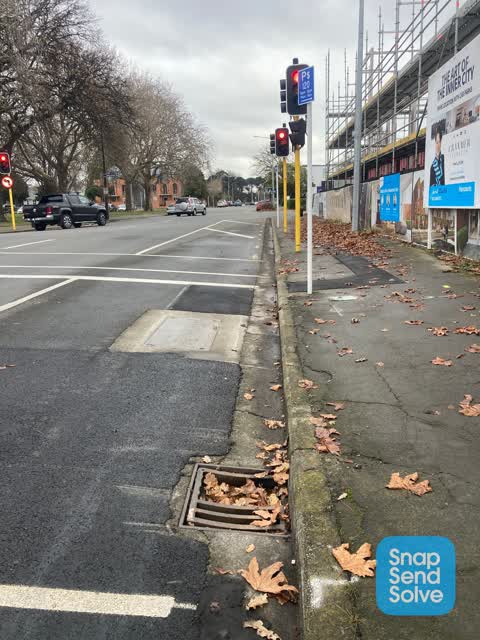
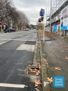 Roading/Streets —
Broken sump cover
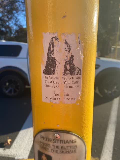
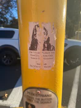 Graffiti —
Anti vax misinformation sticky tags on 2 pedestrians traffic controller poles on the corner of Cranmer Square and Kilmore Street need remova
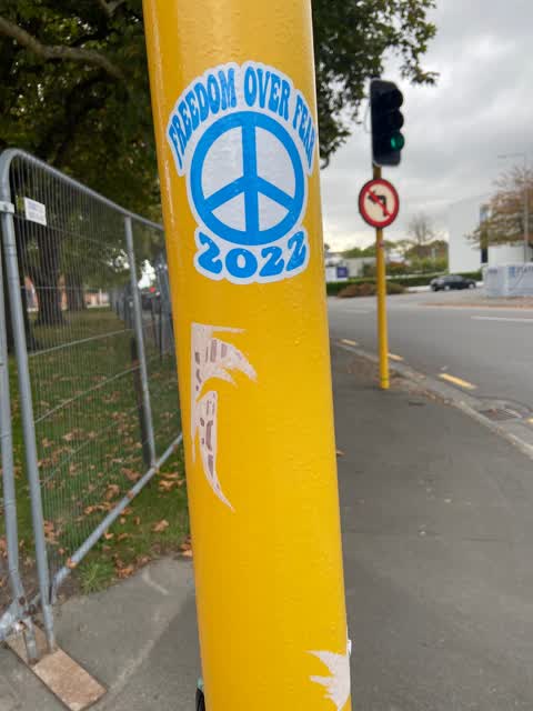
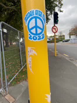 Graffiti —
Anti vax sticky tag on traffic signal pole on the corner of Cranmer Square and Kilmore Street needs removal. Please also forward this email
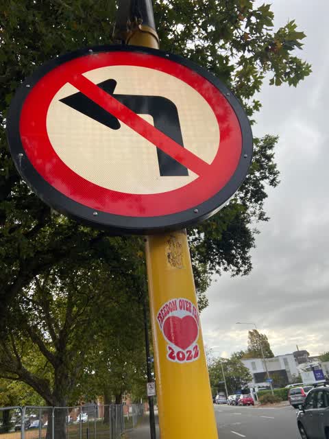
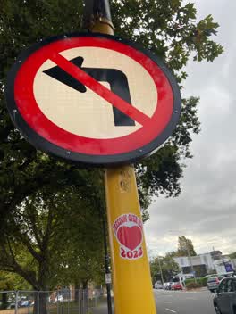 Graffiti —
Anti vax sticky tag on road direction sign by the corner of Cranmer Square and Kilmore Street needs removal. Please also forward this email
Also reported on Kilmore Street
- 70 Kilmore Street — 86 reports
- 211 Kilmore Street — 72 reports
- 294E Kilmore Street — 53 reports
- 277 Kilmore Street — 49 reports
- 254 Kilmore Street — 42 reports
- 86 Kilmore Street — 30 reports
- 284 Kilmore Street — 29 reports
- 229 Kilmore Street — 28 reports
The street’s crash record
NZTA’s record names Kilmore Street in 104 crashes that hurt somebody since 2006 — 1 person killed, 22 seriously hurt.
The green nearby
- Cranmer Square — 7 m to the edge · Botanic · 2 ha
- Victoria Triangles — 151 m to the edge
- Hagley Park North — 250 m to the edge · Sports ground · 91 ha
- Armagh Reserve — 302 m to the edge
- Canterbury Provincial Council Reserve — 318 m to the edge · Botanic
Parks within half a kilometre, measured to the boundary — the council’s open data.
The civic shelf nearby
- Aldersgate — 221 m away · Car park
- Armagh St — 240 m away · Car park
Libraries, halls and the rest within half a kilometre — the council’s open data.
On the doorstep
- Delhi Belly Indian Restaurant — 61 m away · Restaurants
- Polo Bar & Restaurant — 93 m away · Restaurants
- Hotel Montreal — 97 m away · Hotels
- Dorothy's Pop Up Tearooms — 98 m away · Fast food
Businesses within four hundred metres, measured at the pin — OpenStreetMap and the council directories.
The bus nearby
- Victoria St near Peterborough St — 169 m away · route 1, route 29, route 95
- Salisbury St near Victoria St — 260 m away · route 1, route 29, route 95
The closest Metro stops, within four hundred and fifty metres.
The tracks through here
- Walk and bike track through Christchurch Central City — 146 m to the line · walk · bike
- Walk and bike track through Christchurch Central City — 233 m to the line · walk · bike
- Walk and bike track through Christchurch Central City — 243 m to the line · walk · bike
- Walk and bike track through Christchurch Central City — 248 m to the line · walk · bike
- Walk and bike track through Christchurch Central City — 255 m to the line · walk · bike
Tracks whose line passes within half a kilometre, measured to the line itself — the council’s open data.
The named ground
Named water within 500 m of this address, measured to the line or the edge; Named places within 1.5 km of this address; the council’s own structure register — bridges, boardwalks and steps standing nearby — the open map’s record.
The remembered names nearby
- Removed / From Intersection of / High & Manchester Streets — 214 m away ·
REMOVED / FROM INTERSECTION OF / HIGH & MANCHESTER STREETS / AND RE-ERECTED / OCTOBER 1990
· 2009 - Victoria Triangles plaque — 215 m away · 2009
- Diamondjubilee / 1837 - 1897 — 216 m away ·
DiamondJubilee / 1837 - 1897
· 2009
Inscribed plaques within two hundred and fifty metres — the register’s pins, not surveyed spots. The whole roll is at /plaques.
Renting nearby
new bonds in Christchurch Central City ran about $508 a week — $42 below the city median of $550 — the suburb page keeps the rent record →.
What was here — Former Shop/Dwelling and Setting
17 m away · 40 Cranmer Square · located to ±6 m · the place’s own record →
On the register. Nothing researched here yet.
What was here — Dwelling and Setting
25 m away · 38 Cranmer Square · located to ±5 m · the place’s own record →
On the register. Nothing researched here yet.
What was here — Cranmer Square and Setting
122 m away · 1P Cranmer Square · located to ±119 m · the place’s own record →
In the winter of 1869 the City Council fenced Cranmer Square — the works committee had fencing plans prepared in July, and the fortnightly works return at the end of August records men "erecting posts for fencing Cranmer Square".
CHRISTCHURCH CITY COUNCIL. (Star, 27 July 1869) · · National Library of New ZealandIn January 1882 the promoters Joubert and Twopeny asked the City Council for the use of Cranmer Square to erect buildings for an international exhibition they planned to open that April.
THE INTERNATIONAL EXHIBITION. (Star, 14 January 1882) · · National Library of New ZealandAt an informal council meeting on 13 January 1882, Twopeny said the promoters would sign a bond to give the square back "in exactly the same condition as it was before" and would not injure any of its trees; he asked for Cranmer rather than Latimer Square because money had just been spent laying Latimer out.
THE INTERNATIONAL EXHIBITION. (Star, 14 January 1882) · · National Library of New ZealandThe exhibition never came to Cranmer Square. When it opened in April 1882 its buildings stood in Hagley Park, on the angle formed by the junction of the Riccarton and Lincoln roads.
THE INTERNATIONAL EXHIBITION AT CHRISTCHURCH. (Timaru Herald, 12 April 1882) · · National Library of New ZealandBy the early 1900s the houses around Cranmer Square ran heavily as lodging and boarding houses — the Star's columns carry years of boarders wanted, rooms to let and servants sought addressed to numbers 2, 3, 10, 20, 22 and 30.
Page 6 Advertisements Column 1 (Star, 14 January 1905) · · National Library of New ZealandWhat was here — Former St Margaret's School Building and Setting
161 m away · 25A Cranmer Square · located to ±24 m · the place’s own record →
On the register. Nothing researched here yet.
What was here — Former Christchurch Teachers College and Setting
190 m away · located to ±45 m · the place’s own record →
On the register. Nothing researched here yet.
The civic layer
This ground votes in Central ward — the Papanui-Innes-Central community board. Ward lines don’t always follow suburb lines; this one is measured at the pin, not the suburb’s centre.
What stood on this ground → · On the map → · From the air — the Crown’s aerials back to 1936; search the address on RetroLens →
Questions, answered briefly
12 council reports on record since April 2022 — most often graffiti (3), street light outage (2), graffiti somewhere else (2).
Christchurch Central City, Christchurch — on Kilmore Street.
The heritage register names 5 places at or beside it — Former Shop/Dwelling and Setting, Dwelling and Setting.
Cranmer Square — 7 m to its edge, 2 ha.