67 Kilmore Street, Christchurch Central City
15 reports on record since May 2022 · 12 with photographs. The street’s heaviest record is 70 Kilmore Street — 86 reports on file. Indicative rating valuation and school zones, hazards, bin day and what stood here before.
What gets reported here
Photographed here 12 on record


Reported here
 Poles and Signage - General —
P10 loading zone at anytime pole and sign missing
 Water General —
Standing water may be a leak
 Poles and Signage - General —
Traffic pole 8 pedestrian button broken
 Dumped Rubbish —
Large cushion dumped on the footpath by 67 Kilmore Street needs removal. Not the Gaming Lounge possession.
 Graffiti somewhere else —
 Graffiti on a fence, building or structure —
Black paint tag on anonymous large metal asset by 67 Kilmore Street.
 Graffiti on a fence, building or structure —
White paint tag on building wall facing the footpath at 67 Kilmore Street.
 Dumped Rubbish —
Old road sign needs removal from the verge at 67 Kilmore Street.
 Rubbish and Bins - General —
Broken window glass been over footpath for a couple of weeks
- Road Signage —
- Accessibility —
- Graffiti —
 Graffiti —
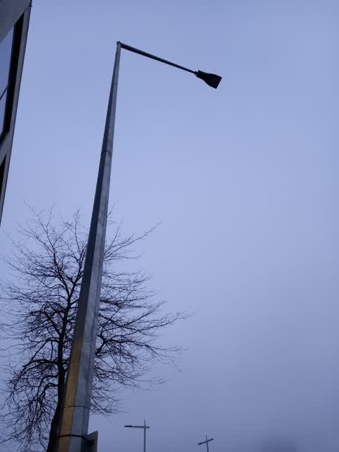
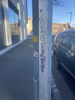
67 Kilmore St - Graffiti on light post
 Graffiti —
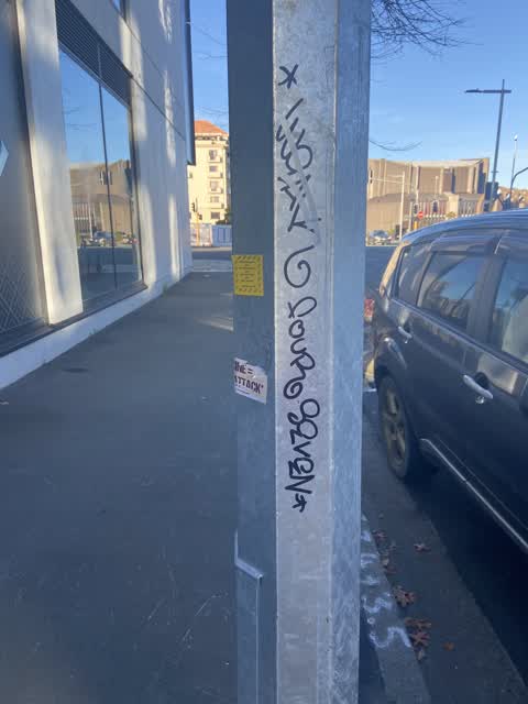
Black paint tag plus anti vax misinformation sticky tags on metal lamp pole on Kilmore Street about Number 67.
 Graffiti —
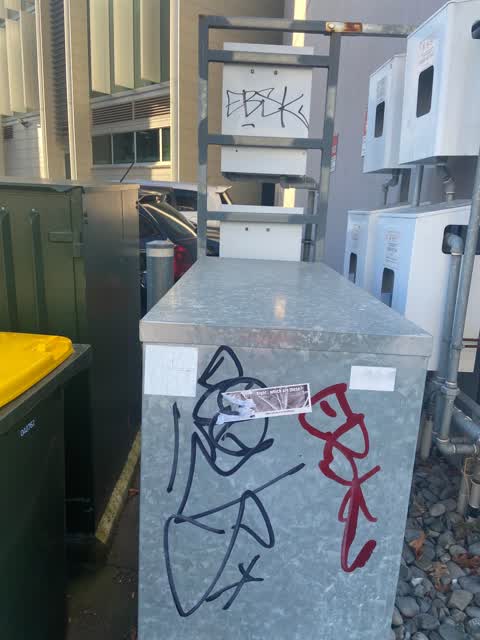
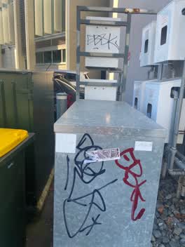
Black and crimson paint tags on anonymous metal utility cabinet by 61 Kilmore facing the footpath.
Also reported on Kilmore Street
- 70 Kilmore Street — 86 reports
- 211 Kilmore Street — 72 reports
- 294E Kilmore Street — 53 reports
- 277 Kilmore Street — 49 reports
- 254 Kilmore Street — 42 reports
- 86 Kilmore Street — 30 reports
- 284 Kilmore Street — 29 reports
- 229 Kilmore Street — 28 reports
The street’s crash record
NZTA’s record names Kilmore Street in 104 crashes that hurt somebody since 2006 — 1 person killed, 22 seriously hurt.
The green nearby
- Victoria Triangles — 90 m to the edge
- Cranmer Square — 162 m to the edge · Botanic · 2 ha
- Victoria Square — 227 m to the edge · Botanic · 2 ha
- Canterbury Provincial Council Reserve — 260 m to the edge · Botanic
- Aldred Reserve — 305 m to the edge
Parks within half a kilometre, measured to the boundary — the council’s open data.
The civic shelf nearby
- Aldersgate — 159 m away · Car park
- Armagh St — 212 m away · Car park
Libraries, halls and the rest within half a kilometre — the council’s open data.
On the doorstep
- Jolly Poacher — 16 m away · Restaurants
- Schnitz Bar & Restaurant — 17 m away · Bars & pubs
- The Good Goat Gastro Pub — 18 m away · Restaurants
- Schnitz & Co — 19 m away · Bars & pubs
Businesses within four hundred metres, measured at the pin — OpenStreetMap and the council directories.
The bus nearby
- Kilmore Street Town Hall — 163 m away · route 1, route 29, route 95
- Victoria St near Peterborough St — 197 m away · route 1, route 29, route 95
The closest Metro stops, within four hundred and fifty metres.
The tracks through here
- Walk and bike track through Christchurch Central City — 28 m to the line · walk · bike
- Walk and bike track through Christchurch Central City — 241 m to the line · walk · bike
- Walk and bike track through Christchurch Central City — 245 m to the line · walk · bike
- Walk and bike track through Christchurch Central City — 291 m to the line · walk · bike
- Walk and bike track through Christchurch Central City — 338 m to the line · walk · bike
Tracks whose line passes within half a kilometre, measured to the line itself — the council’s open data.
The named ground
Named water within 500 m of this address, measured to the line or the edge; Named places within 1.5 km of this address; the council’s own structure register — bridges, boardwalks and steps standing nearby — the open map’s record.
The remembered names nearby
- In Conjunction With the Christchurch Beautifying — 172 m away ·
IN CONJUNCTION WITH THE CHRISTCHURCH BEAUTIFYING ASSOCIATION INC. THIS FLORAL CLOCK WAS PR
· 2009 - This Floral Clock Was Presented to the Citizens — 172 m away ·
THIS FLORAL CLOCK WAS PRESENTED TO THE CITIZENS OF CHRISTCHURCH BY CALDER MACKAY CO. LTD 1
· 2009 - Victoria Bridge — Historical Description 1851–1989 — 228 m away ·
VICTORIA BRIDGE — HISTORICAL DESCRIPTION 1851–1989
· 2009
Inscribed plaques within two hundred and fifty metres — the register’s pins, not surveyed spots. The whole roll is at /plaques.
Renting nearby
new bonds in Christchurch Central City ran about $508 a week — $42 below the city median of $550 — the suburb page keeps the rent record →.
What was here — Former Shop/Dwelling and Setting
139 m away · 40 Cranmer Square · located to ±6 m · the place’s own record →
On the register. Nothing researched here yet.
What was here — Dwelling and Setting
141 m away · 38 Cranmer Square · located to ±5 m · the place’s own record →
On the register. Nothing researched here yet.
What was here — Floral Clock and Setting
173 m away · 66 Chester Street West · located to ±5 m · the place’s own record →
On the register. Nothing researched here yet.
What was here — The Christchurch Town Hall and Setting
211 m away · located to ±79 m · the place’s own record →
On the register. Nothing researched here yet.
What was here — Former Market Place Bridge/Hamish Hay Bridge and Setting
221 m away · located to ±31 m · the place’s own record →
On the register. Nothing researched here yet.
The civic layer
This ground votes in Central ward — the Papanui-Innes-Central community board. Ward lines don’t always follow suburb lines; this one is measured at the pin, not the suburb’s centre.
What stood on this ground → · On the map → · From the air — the Crown’s aerials back to 1936; search the address on RetroLens →
Questions, answered briefly
15 council reports on record since May 2022 — most often graffiti (4), poles and signage - general (2), graffiti on a fence, building or structure (2).
Christchurch Central City, Christchurch — on Kilmore Street.
The heritage register names 5 places at or beside it — Former Shop/Dwelling and Setting, Dwelling and Setting.
Victoria Triangles — 90 m to its edge.