
Heathcote Valley, Christchurch
3,279 council reports since May 2015, the 45th busiest suburb in the city. 2,627 photographs on record. 2,430 people at the 2023 Census, 293 to the square kilometre across 8.3 km².
The record also holds about $750 a week to rent· 2023 Census snapshot· 2,627 photographs· 29 old photographs· 1 school· 15 parks· 1 place of worship· 3 tracks· 14 names on the map· 1.5% of the outline mapped liquefied· 8.3% of the outline in the red zone· graded mostly TC2 in 2011· the record drew water over 5% of the outline· the mapped tsunami reach covers 1% of the outline· slope-hazard bands cover 37% of the outline· the Ngāi Tahu schedule covers 2% of the outline· landscape schedules over 63% of the outline· setback strips over 6% of the outline· 1,593 SCIRT photographs filed on this ground· 2.7 km of cycleway crosses the outline· 4 remembered names on this ground· 23 drawn rules bind this ground· 4 parcels on the dangerous-work register· 124 parcels of made ground· 5,632 surveyed rocks· 2 parcels with a cleanup on file· the 2019 model grades this ground mostly unlikely· 96 engineered defences· 29 council structures on the register· 9 recreation register records· 763 trees on the register· the plan’s word on this ground· 5% of the outline reserved· 1 place on the heritage schedule· 103 epicentres inside the outline· 66 injury crashes· 347 recorded victimisations· 25 bus stops· 15 businesses· the council’s fix times· 3 heritage places· 40 documents· 5 mentions on the wire
Live source links
Link-outs to the source’s own live pages, chch.live does not copy their live values or source text.
Living here rent · the ground · the day-to-day
$750/week
middle half $623–$758
New bonds here ran at about $750 a week in the April–June 2026 quarter, the middle half of them between $623 and $758, across 6 bonds lodged, up 27% on a year ago. That’s about $200 a week above the city’s own quarter median of $550. Tenancy Services counts these under the “Heathcote Valley” statistical area, close to this suburb’s outline, not exactly it.
Median and quartiles of weekly rents on new private bonds, by quarter. New bonds are fresh lodgements, not the whole rental stock; under five bonds the rent is withheld, and counts are randomly rounded. Source: Tenancy Services rental bond data: provisional while the bond system migrates.
The ground: 8% of the outline went into the residential red zone; the February 2011 survey drew liquefaction over 1% of it, the rest of the watch is drawn further down.
Day to day it holds 1 school, 15 parks, 1 place of worship, 3 tracks and 25 bus stops, each is counted further down.
Lately the record’s mostly graffiti & vandalism, 373 reports in the year to 12 October 2026, the newest 11 October 2026.
One for the quiz, Its busiest day on record was 14 August 2017, 14 reports in a single day.
2023 Census snapshot SA1 areas grouped here
About 2,379 people and 1,011 occupied private households in the “Heathcote Valley” statistical area, grouped from 17 SA1 areas. This exact statistical-area match is close to this suburb’s outline, not exactly it.
More of the 2023 Census
- Born overseas22% of stated birthplace
- European ethnicity93% of ethnicity responses
- Māori ethnicity9% of ethnicity responses
- Pacific Peoples ethnicity1% of ethnicity responses
- Asian ethnicity4% of ethnicity responses
- Households with internet85% of stated households
- Households with two or more vehicles57% of stated households
Ethnicity is a multiple-response measure, so those percentages are not meant to add to 100%.
Stats NZ’s 2023 Census uses fixed random rounding to base 3. Unavailable or confidential cells are left out, not treated as zero. individuals · households · geography · CC BY 4.0.
About the suburb
Heathcote Valley is a suburb of Christchurch, New Zealand. It is named after Sir William Heathcote, who was secretary of the Canterbury Association.
As reported 2,627 on record
The suburb, back then 29 in the archive
Placed by the record’s locality join or the name in its own title, a lead, not a claim each frame stood here.
The shape of it outline © OpenStreetMap · recent reports, pinned
The record on Heathcote Valley
- Heathcote Valley enters the written record on 25 January 1851, “WALKS ON THE ROADS. (Lyttelton Times, 25 January 1851)”, Papers Past.
- “Heathcote Valley” appears somewhere in 532 of the archive’s records, title, description or body.
- A Papers Past search for the name surfaced 30 records, leads by provenance, not by phrase.
- The first report the feed ever carried here: other, 31 May 2015, at 13.
- Its busiest day on record was 14 August 2017, 14 reports in a single day.
- The street that keeps coming up is Port Hills Road, reported on 550 separate days.
- For elections the suburb’s centre falls inside Heathcote ward, the Spreydon-Cashmere-Heathcote community board is its local layer. The whole roll is at /wards.
Lately the newest reports

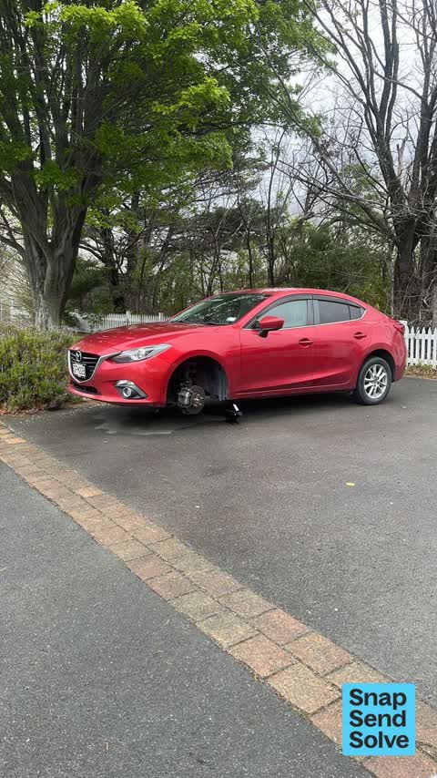
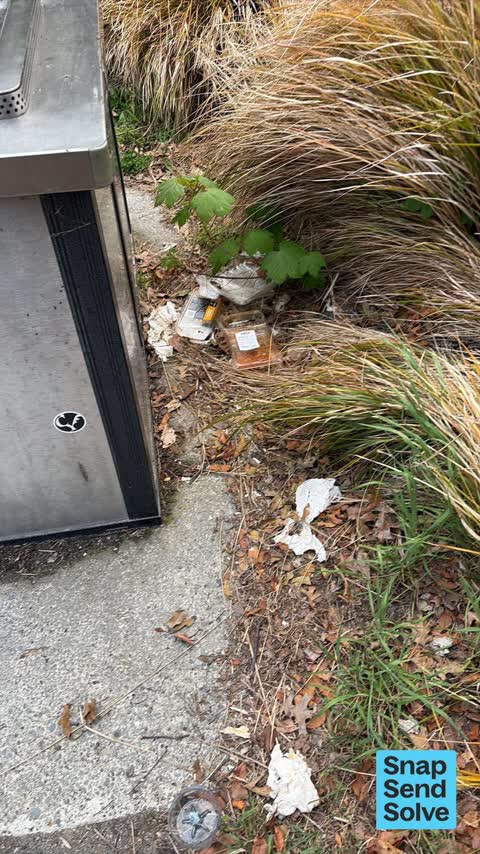


Dumped RubbishHeathcote Domain 45 Bridle Path Road


Animal - General1039–1139 Summit Rd
Lamb is the wrong side of the fence and crying. Can’t catch it to lift it back over to be with the other. No sheep the road side, only a lamb Please let…

General RequestPort Hills Rd near Vega Pl
Large election hoarding on council berm. Adjacent to NPD and French Bakery (before Chapmans Road).


Water Leak5–9 Bridle Path Rd
I’ve been past here a couple of times in last week or so and theground is very boggy and it sounds like there is water running.

Water Leak37 Laing Crescent
Hi. this is at the end of my shared drive way. I am 1/37 Laing Crescent and this meter is for 39 Laing Crescent
Reports per year down 1% 2024→2025
15
41
16
84
17
99
18
179
19
306
20
330
21
356
22
419
23
389
24
394
25
391
What gets reported
Exactly what people say
How fast the council fixes things here 4,699 finished jobs on record
The median council work order pinned in Heathcote Valley took 4 days to resolve, the city-wide median is 3 days, so this ground runs slower than the city as a whole. The slowest tenth waited 3 months or longer. 106 tickets are open here now, the oldest was filed 14 November 2018.
Work orders, not the resident reports above, the council’s MyCouncilTicket stream, and one job can appear in both. A median counts only finished jobs; open ones are named as open, never averaged in. The ticket roll · the whole city’s fix times.
Alcohol rules on this ground
One sensitive site stands here, Heathcote Valley School, and the Local Alcohol Policy restricts new off-licences within 200 m of it.
The council’s bylaw zones and the Local Alcohol Policy’s buffer list, read from the Regulatory open-data service. A ban rules drinking in public places; it says nothing about whether a premises may sell, that is the licence register’s job.
The suburb today
Schools here 1
- Heathcote Valley SchoolFull Primary · decile 9 · EQI 424
Zoned for Christchurch Adventist School · Hillview Christian School · Marian College · Middleton Grange School · St Anne's School (Woolston) · St Thomas of Canterbury College · and 4 more zones, the drawn zone is indicative; the Ministry’s written scheme is the legal boundary.
Decile and EQI describe the community a school draws from, not how well it teaches.
The green here 15
- Scotts Valley ReserveRegional · 130 ha
- Castle Rock ReserveRegional · 89 ha
- The Duncan Park24 ha
- Mt Pleasant ReserveRegional · 13 ha
- Bridle Path WalkwayRegional · 9 ha
- Heathcote Quarry ReserveRegional · 8 ha
- Tors Scenic ReserveRegional · 5 ha
- Heathcote DomainSports ground · 4 ha · playground, 52 pieces
The first eight of 15, Parks and reserves in the council’s open data, a park lands in the suburb its centre falls inside. The whole roll is at /parks.
Where the suburb worships 1
- The Church of St Mary Anglican Churchan Anglican church · 2 Martindales Road
Places of worship in the open map’s record, one lands in the suburb its building stands in. The whole roll is at /worship.
The tracks through here 3
- Walk and bike track through Heathcote Valley2.2 km · Christchurch · walk · bike
- Walk and bike track through Heathcote Valley1.4 km · Christchurch · walk · bike
- Walk and bike track through Heathcote Valley1.2 km · Christchurch · walk · bike
Tracks in the council’s open data, a line belongs to every suburb it passes through. The whole network is at /tracks.
The names on this ground 14
The February 2011 survey drew mapped ground failure over 1.5% of this outline, about 12 hectares. A patch is a footprint, not a finding about an address; the count for the whole city is at /liquefaction.
The Crown’s 2011 classification drew 8.3% of this outline, about 69 hectares inside the residential red zone. A mapped area files under the suburb its middle sits in, and a classification is the record of a decision, not a finding about an address; the whole line is drawn at /redzone.
The 2011 grading filed 6.1% of this outline, about 51 hectares, mostly TC2. A graded area files under the suburb its middle sits in, and a category is a verdict for a patch of ground, not a finding about an address; the grades are drawn at /technical-categories.
The flood record drew water over 5.2% of this outline, about 43 hectares, across 1 named event. A patch is one event’s observation, not a live hazard finding; the whole record is drawn at /floods.
The mapped tsunami extent covers 1% of this outline. The sea’s modelled reach, not a prediction, the plan’s inundation line, not the evacuation zones; the share is read from a sampled join. The whole extent is drawn at /tsunami.
The plan’s slope-hazard bands cover 37% of this outline, about 304 hectares, rockfall management area 1, rockfall management area 2, mass movement management area 2. The broad remaining-instability overlay covers 50% of it besides, the plan’s background watch over the hill country. Shares read from a sampled join; a management overlay, not a prediction. The whole watch is drawn at /slope.
4 parcels inside this outline sit on the hazardous-activities register, mostly vehicle refuelling, service and repair, any other land that has been subject to the intentional or accidental release of a hazardous substance in sufficient quantity that it could be a risk to human health or the environment, cemeteries and waste recycling, treatment and disposal, 2 still doing the work. A listing records the work, not a soil test; the whole register is drawn at /hazards.
The files record 124 parcels of made or characterised ground inside this outline, about 38 hectares, mostly silt, engineered fill, buried topsoil, 2 carry fill the file can’t vouch for. A record is the file’s word on what was laid, not a fresh survey; the whole layer is drawn at /fill.
The rockfall survey mapped 5,632 rocks inside this outline across 1,899 survey pins, 3,375 came down, 279 still wobble easy. A pin may stand for a cluster and marks where the survey saw the rock, not where it is now; the whole survey is drawn at /boulders.
2 parcels inside this outline carry a cleanup on the file. A cleanup on the file is the register’s word, not a clearance; the whole register is drawn at /remediated.
The 2019 liquefaction study put 76% of this outline in the "unlikely" class. A class is the model’s verdict on a patch of ground, not a finding about an address; the whole study is drawn at /vulnerability.
The register puts 96 engineered rockfall defences inside this outline, 38 rock cables, 33 rock anchors, 20 mesh drapes, 1 rated poor or worse on the file. Nearly all are the emergency works the quake years left standing; the whole register is drawn at /defences.
The council’s structure register stands 29 assets on this ground, 14 sets of steps, 7 bridges, 4 boardwalks, 3 ramps, sited at Heathcote Domain, Port Hills 13 Rrz Land, Heathcote Combined Cmty Centre, Heathcote Domain, Com Centre. The register’s site names are its own labels for the ground an asset stands in; the layer is drawn at the map.
The recreation register keeps 9 records inside this outline, bookable surfaces for 5 cricket, 2 football, 1 bowls, 1 basketball. Seasons and surfaces are the register’s record, not this week’s draw; the layer is drawn at the map.
The register counts 763 living trees inside this outline, 11 veterans among them, 22 carrying a protection, mostly Pin Oak, Kowhai, Cabbage tree. The file remembers 219 trees felled here. A tree record is the register’s word on what stands or stood; the whole canopy is drawn at /trees.
The plan files 33% of this outline under Rural Port Hills, 12% residential, the rest mostly Open Space Natural 31%, Rural Urban Fringe 11%. A zone is a permission, not a description, the mix is read from a sampled join of the plan’s polygons; the whole district is drawn at /zones.
The plan reserves about 40 hectares of this outline, 5%, under 5 designations, mostly movement, power & signal. A designation is a claim on the ground, not a build date, the mix is read from a sampled join; the whole register is drawn at /designations.
The plan’s heritage schedule protects 1 place by name in this suburb, 1 graded highly significant, St Mary's Church and Setting. A setting is the ground the item stands in, each files under the suburb holding its centroid; the whole schedule is at /heritage.
The plan’s schedule of sites significant to Ngāi Tahu covers 2% of this outline, about 20 hectares, wāhi tapu/wāhi taonga, ngā tūranga tūpuna. A silent-file precinct covers 7% of it besides, sensitive ground the plan flags without naming the sites. Shares read from a sampled join; a recognition overlay, not a catalogue. The whole schedule is drawn at /cultural.
The plan’s landscape schedules cover 63% of this outline, about 524 hectares across 3 scheduled areas, 63% of it outstanding, the plan’s strongest landscape standing. Shares read from a sampled join; a protection overlay, not a ranking of views. The kept view is drawn at /landscape.
No high-hazard flood area covers this outline. The broader flood-management watch covers 4% of it, Avoca Heathcote Valley, Heathcote River. Shares read from a sampled join; a model’s map, not a promise. The waiting water is drawn at /flood-hazard.
The plan’s water-margin layers cross this outline, 77 classified reaches, the plan calling Bridle Path Waterway and Whites Waterway by name, 6% of it inside the setback strips, the widest holding 20 m off the bank. The margin is the plan’s drawing, not a survey of the bank; the reaches, strips and held edges are mapped at /water-margin.
The rebuild’s cameras filed 1,593 photographs on this ground, 2010–2017, wastewater work mostly. Each frame is a receipt the dig left behind, a work log, not a survey of what stands now; the whole record is drawn at /rebuild.
The pedal network threads this ground, 2.7 km of cycleway crosses the outline, 0.5 km of it separated from the traffic, Heathcote Expressway. A segment counts under every suburb its path enters; the whole network is drawn at /cycleways.
The remembered names stand on this ground, 4 inscribed plaques, Heathcote Domain, Martindales Reserve No. 2, Heathcote Domain, Com Centre among the grounds. The plaque is the register’s pin, not a surveyed spot; the whole roll is kept at /plaques.
The rulebook binds this ground, 23 drawn instruments, 21 of them dog rules, 2 bottle-store buffers; the outline sits inside the takiwā of Rapaki Runanga and Te Ngai Tuahuriri Runanga. The bylaw is the instrument, this the map of it, the whole rulebook is drawn at /rules.
GeoNet’s catalogue puts 103 magnitude-3+ epicentres inside this outline since the sequence opened, the biggest a M6.2 in 2011. An epicentre is where the instruments placed the break, not a measure of the shaking here; the whole catalogue is counted at /sequence, the live record is /quakes, and the story in plain language is the earthquakes explainer.
- Flindersartwork · Zoe Ayton Shaw
- Castle Rockcrag
- Cattle Stop cragcrag
- John Britten cragcrag
- Upper Gondola Stationlookout
- Heathcote War Memorialmonument
- old Heathcote Quarry sitequarry
- Te Moenga-o-Wheke/The Torsrock
- Te Tihi-o-Kahukura/Castle Rockrock
- Mount Cavendishsummit · 445 m
- Tauhinukorokio / Mount Pleasantsummit · Tauhinukorokio
- Te Moenga-o-Wheke / The Torssummit · Te Moenga-o-Wheke
- Te Tihi-o-Kahukura / Castle Rocksummit · Te Tihi-o-Kahukura
- Avoca Valley Streamwaterway · 1.4 km
The named waterways, bays, headlands, monuments, summits and old sites OpenStreetMap puts inside this outline, a pin is the mapper’s own; a waterway belongs to every suburb it crosses. Every roll, counted: /geography.
The crash record 66 injury crashes
66 crashes that hurt somebody on record inside Heathcote Valley's outline, 3 people killed, 16 seriously hurt.
The corner that keeps appearing: State Highway 76 at Chapmans Road, 4 injury crashes.
The crime record 347 recorded victimisations
347 victimisations on the Police record inside Heathcote Valley’s outline, September 2022–August 2026, mostly theft, about 36 a year per 1,000 residents. Down 22% on the year before. Reported is not all, how much never reaches the record depends on the offence.
The buses through it 25 stops
25 Metro stops inside Heathcote Valley's outline, in ECan’s stop record, served by route 8, route 155.
- Bridle Path Rd
- Bridle Path Rd
- Bridle Path Rd near Hammerton Ln
- Bridle Path Rd near Port Hills Rd near Bridle Path Rd
- Bridle Path Rd near Port Hills Rd near Bridle Path Rd
- Bridle Path Rd near Rollin St near Bridle Path Rd
- Bridle Path Rd near Rollin St near Bridle Path Rd
- Christchurch Gondola
- Heathcote near Bridle Path Rd
- Heathcote near Bridle Path Rd
- Heathcote near Martindales Rd
- Heathcote near Martindales Rd
- Martindales Rd near Station Rd
- Martindales Rd near Truscotts Rd
- Port Hills Rd near Ardtrea Ln near Port Hills Rd
- Port Hills Rd near Ardtrea Ln near Port Hills Rd
Businesses here 15 in the directory
15 premises in Heathcote Valley across 9 kinds, from OpenStreetMap, the council’s licensed-premises register and its 2024 Find Christchurch directory. Each kind below opens at this suburb’s shelf.
- Attractions3
- Cafés3
- Bars & pubs2
- Restaurants2
- Clubs1
- Dairies & convenience1
- Galleries1
- Gift shops1
- Hairdressers1
Among them, the ones the record says most about:
Before any of that
On the register here
Documents 40
What the archive’s sources say about Heathcote Valley, titled for it, turned up by a search for one of its places, or carrying its name in the text. These are leads and citations: the originals live at the provider, linked from each row.
761850s
1161860s
521870s
1301880s
481890s
691900s
191910s
71920s
31930s
41940s
41950s
31960s
31970s
21980s
152000s
122010s
72020s
WALKS ON THE ROADS. (Lyttelton Times, 25 January 1851)Lyttelton Times · Papers Past · National Library of New Zealand · · text held
WALKS ON THE ROADS. (Wellington Independent, 19 February 1851)Wellington Independent · Papers Past · National Library of New Zealand · · text held
Page 8 Advertisements Column 1 (Lyttelton Times, 31 January 1852)
to be let in the heathcote valley near the bridle path a convenient house with a stable attached well situated for an inn or ho…Lyttelton Times · Papers Past · National Library of New Zealand · · text held
Page 8 Advertisements Column 2 (Lyttelton Times, 14 February 1852)
…00901902 apply to mr hart at the white hart adjoining the above sections to be let in the heathcote valley near the bridle path a convenient house with a stable attached well situated for an inn or ho…Lyttelton Times · Papers Past · National Library of New Zealand · · text held
Page 10 Advertisements Column 1 (Lyttelton Times, 14 August 1852)Lyttelton Times · Papers Past · National Library of New Zealand · · text held
Page 12 Advertisements Column 1 (Lyttelton Times, 14 August 1852)Lyttelton Times · Papers Past · National Library of New Zealand · · text held
Page 10 Advertisements Column 2 (Lyttelton Times, 14 August 1852)Lyttelton Times · Papers Past · National Library of New Zealand · · text held
Page 11 Advertisements Column 3 (Lyttelton Times, 14 August 1852)Lyttelton Times · Papers Past · National Library of New Zealand · · text held
Page 11 Advertisements Column 2 (Lyttelton Times, 14 August 1852)Lyttelton Times · Papers Past · National Library of New Zealand · · text held
Page 12 Advertisements Column 3 (Lyttelton Times, 14 August 1852)Lyttelton Times · Papers Past · National Library of New Zealand · · text held
The rest are a search away, the whole shelf, for the name →
The wire on Heathcote Valley 5 lately
Myosotis australis seen — Heathcote Valley, Christchurch, New ZealandiNaturalist · meurkc ·
Luzula banksiana seen — Heathcote Valley, Christchurch, New ZealandiNaturalist · meurkc ·
Comb fern seen — Heathcote Valley, Christchurch, New ZealandiNaturalist · meurkc ·
Silver Tussock seen — Heathcote Valley, Christchurch, New ZealandiNaturalist · meurkc ·
Domestic Sheep seen — Heathcote Valley, Christchurch, New ZealandiNaturalist · meurkc ·
56 more documents came up in searches for Heathcote Valley's places and have not been read yet, a lead is a search result, not a fact, until somebody reads it.
Next door
Compare Heathcote Valley with Ferrymead · Mount Pleasant · Redcliffs · Lyttelton · Cass Bay · Hillsborough, same record, side by side.
Questions, answered briefly
What is Heathcote Valley?
Heathcote Valley is a suburb of Christchurch, New Zealand. The public record holds 3,279 council reports for it, the first filed in May 2015.
How many people live in Heathcote Valley?
2,430 people at the 2023 Census, 293 per square kilometre across 8.3 km².
How many people does the 2023 Census count for Heathcote Valley?
About 2,379 people and 1,011 occupied private households: grouped from Stats NZ SA1 areas through this site’s suburb join. Indicative, not a LIM.
What gets reported in Heathcote Valley?
3,279 reports on record, most often graffiti & vandalism (770), water & drains (676), trees & parks (637). 373 of them in the year to 12 October 2026.
How many crashes has Heathcote Valley had?
66 injury crashes on the police record inside the suburb’s outline, 3 people killed, 16 seriously hurt. The suburb’s crashes, mapped →
Did earthquakes strike under Heathcote Valley?
GeoNet’s catalogue puts 103 magnitude-3+ epicentres inside the suburb’s mapped outline since the September 2010 mainshock, the biggest a M6.2 in 2011. An epicentre is where the instruments placed the break, not a measure of the shaking felt here. The whole sequence, counted → · The story, in plain language →
Every suburb in Christchurch → · Its decade, charted → · the whole A–Z →